 Wildlife Tag
Upper Grades Ecosystem Investigation: Weather Station
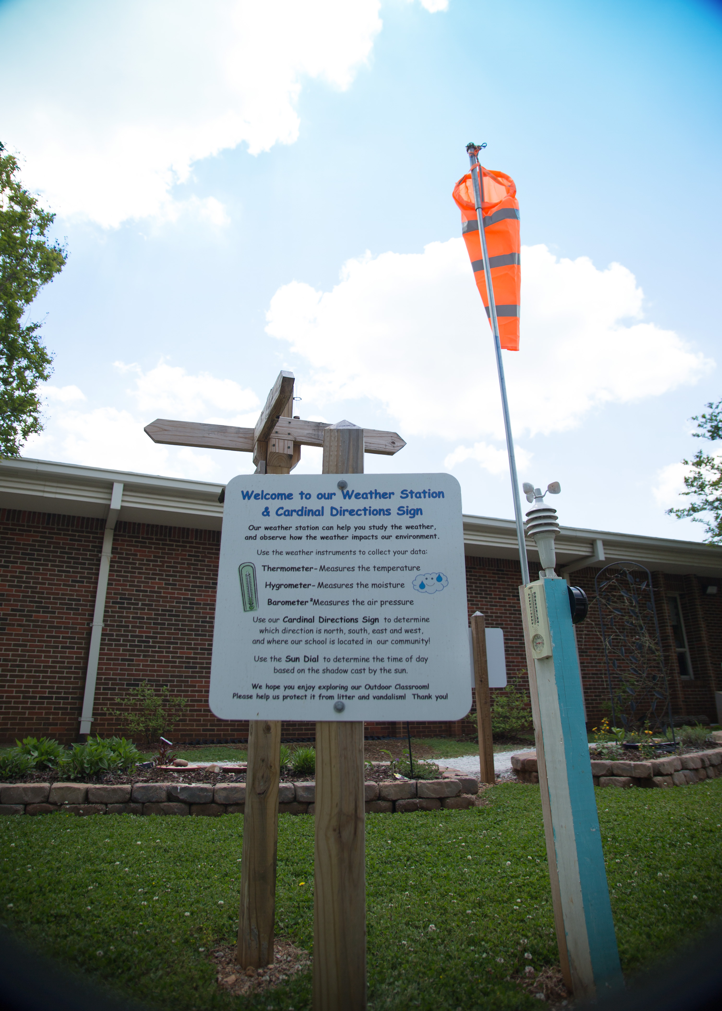 |
| Riverton Elementary Weather Station Click on image to enlarge it |
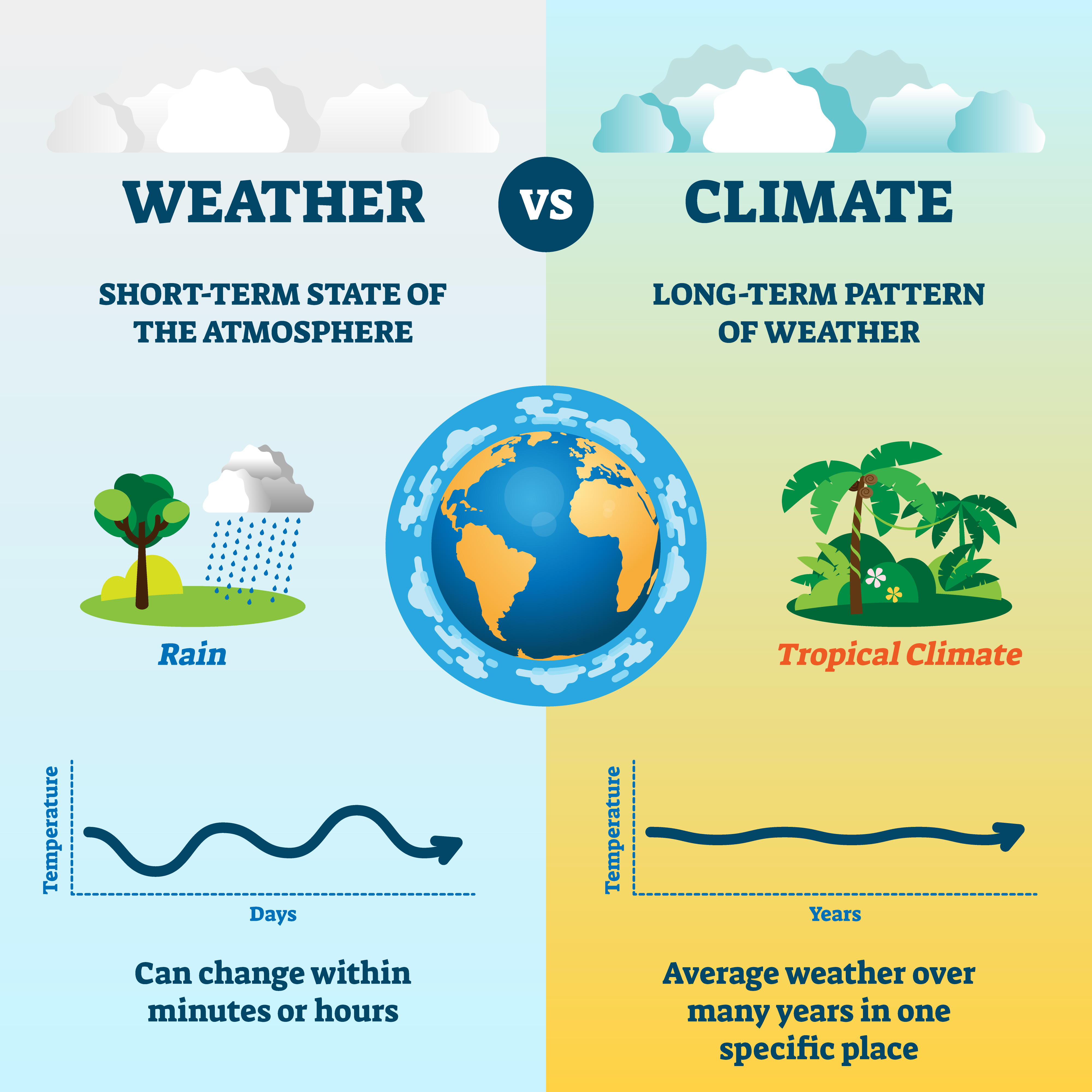
 Investigate Alabama's Weather
The weather station in your outdoor classroom includes various weather instruments that you can use to measure, record and track weather conditions over time.
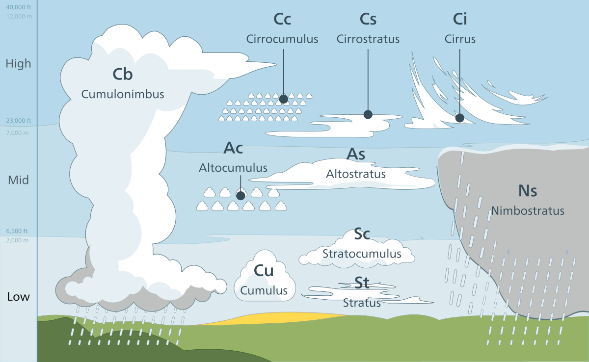
Observing the clouds overhead can help you understand and predict weather.
| Click on the icons below to learn more! | |||
|
|
|
 |
|
| Alabama's Climate | Alabmama's Weather Patterns |
Weather Instruments | Clouds |
| Alabama's Weather Patterns | |
|
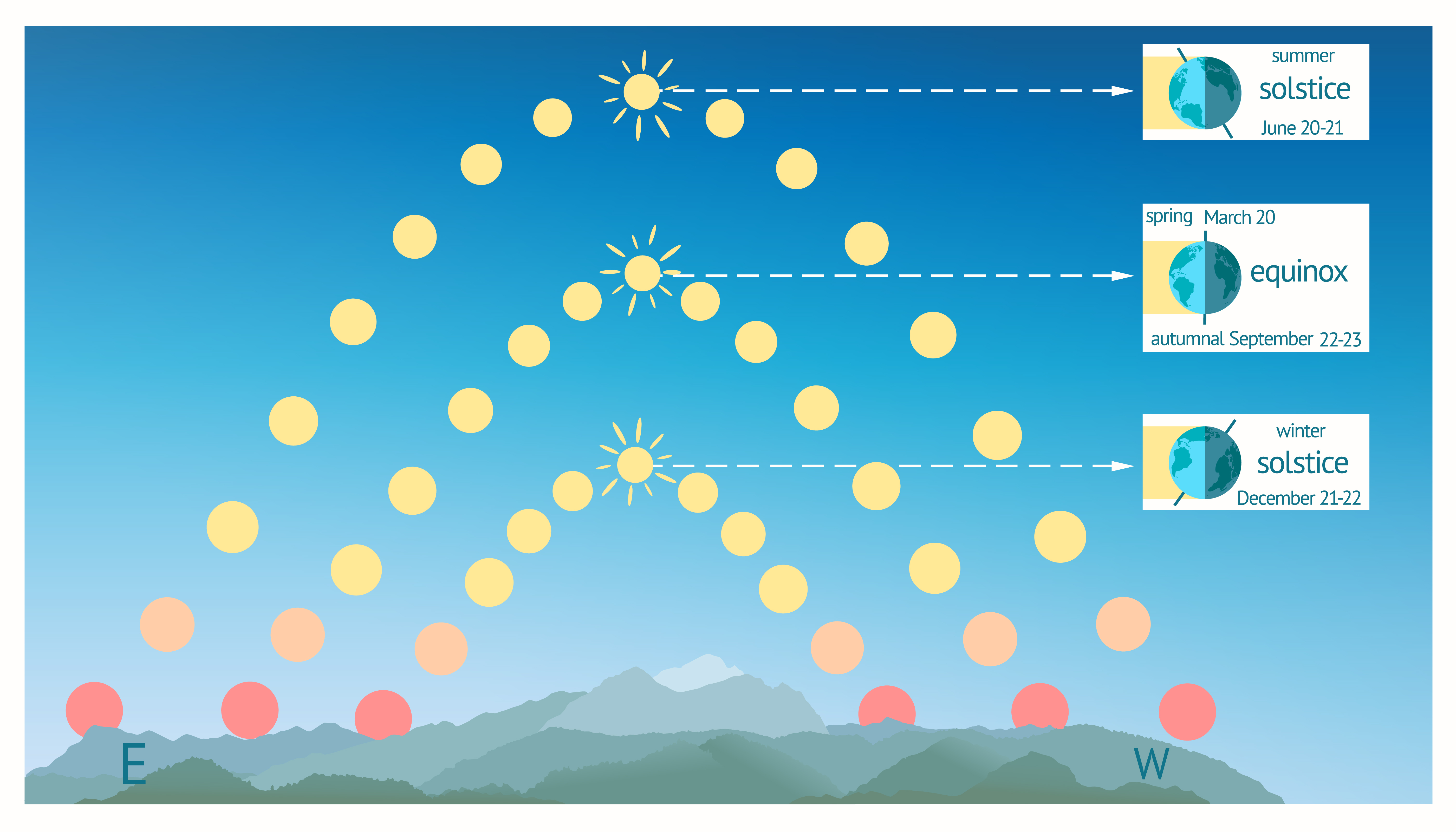
Seasons in Alabama:
Because of Earth’s orbit around the sun and its tilt, we experience variations in day length and temperature patterns throughout the year. This, as well as large air masses moving over the continent, gives us seasons! |
|
|
In fall, cool, dry air (a Continental Polar air mass) moves southward into the state. These cold fronts force the warm, moist air upward into the atmosphere, causing rain showers or even snow. Once the rain or snow clears, we typically experience several days of cool, sunny weather until the next cold front comes in. The cool Continental Polar air masses typically stop moving southward around March (the end of winter and start of spring) and the warm maritime air masses dominate our weather once more. |
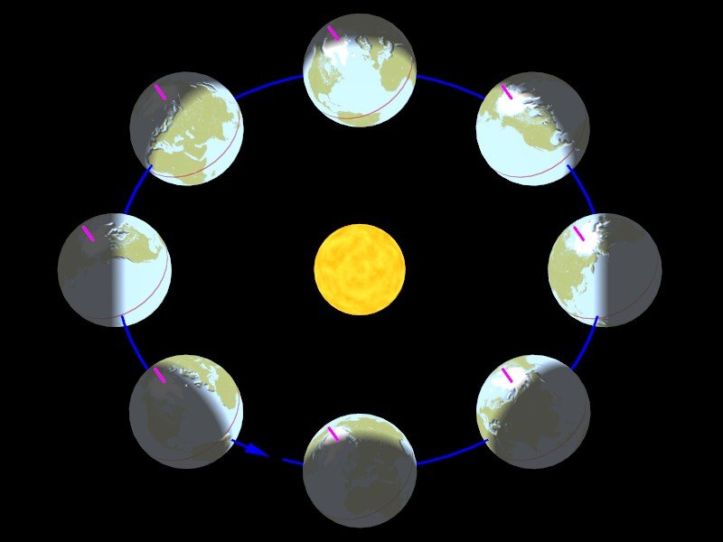 Earth's Tilt
Wikimedia - Saperaud |
|
Day Length:
The shortest length of day that we experience is in late December. We call this the Winter Solstice. In Alabama, we get 10 hours of daylight. The longest length of day that we experience is in late June. This is the Summer Solstice. In Alabama, we get 14 hours of daylight. |
 Dreamstime
Click on image to enlarge it |
|
Temperature:
Average temperatures are slightly higher in the southern half of the state then in the northern half of the state. For example, take the average minimum daily temperature in the coldest month versus the hottest month across the state. |
|
| Average minimum daily temperature (°F) in January | Average maximum daily temperature (°F) in July | |
| Mobile County (South) | 39.9 | 91.2 |
| Montgomery County (Central) | 35.8 | 93 |
| Madison County (North) | 29.3 | 86.5 |
| You’ll notice that average maximum daily temps in Montgomery County are higher than in Mobile County, which is farther south. This is because Mobile County is coastal and is influenced by the Maritime Effect. The Gulf of Mexico’s airflow impacts the climate of the areas nearby, causing milder temperatures and less variation in temperature. |
|
Alabama's record breaking temperatures:
Highest recorded temp in AL: 112°F at Centreville, Bibb County, on September 5, 1925Lowest recorded temp in AL: -27°F at New Market, Madison County, on January 30, 1966 |
|
Precipitation:
The northern half of the state also has higher average levels of precipitation than the southern half. |
| Average Annual Precipitation (inches) | |
| Mobile County (South) | 57 |
| Montgomery County (Central) | 53.1 |
| Madison County (North) | 65.9 |
| Weather Instruments | |
| Your weather station should have a cardinal direction sign as well as some or all of the weather instruments listed below. | |
| Cardinal Direction Sign: The cardinal direction sign is used to remind you which direction is North, South, East, and West. This is helpful when studying wind patterns in particular. |
|
|
Thermometers:
Thermometers measure the air temperature. When air around the tube of liquid (such as alcohol or mercury) changes temperature, the liquid expands and moves up the tube. A scale then shows what the actual temperature is. |
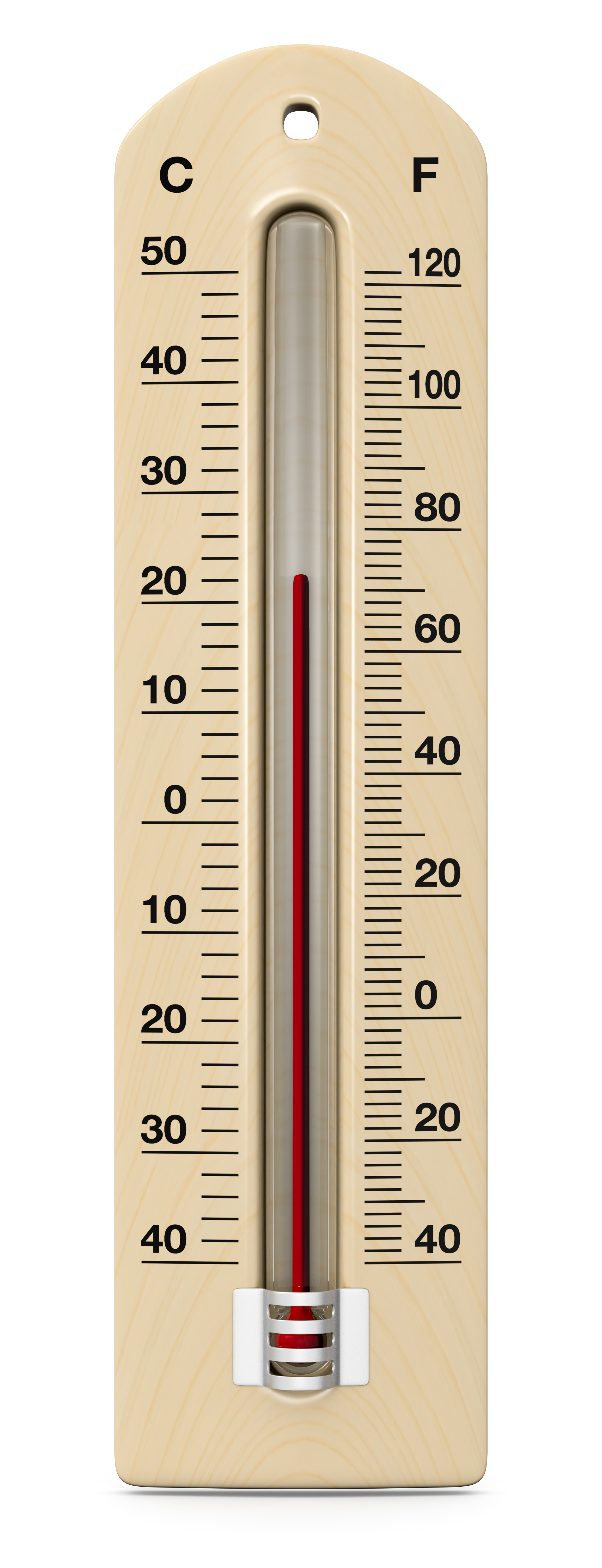 Thermometer
|
| Anemometers: Anemometers measure wind speed. Cups attached to horizontal bars catch the wind. Those bars are all attached to a single vertical rod that rotates as the cups catch wind. The anemometer counts the number of rotations of the vertical rod and determines the wind speed. Because wind isn’t constant, but rather in gusts and lulls, wind speed is actually determined by the average recorded speed over a short period of time. |
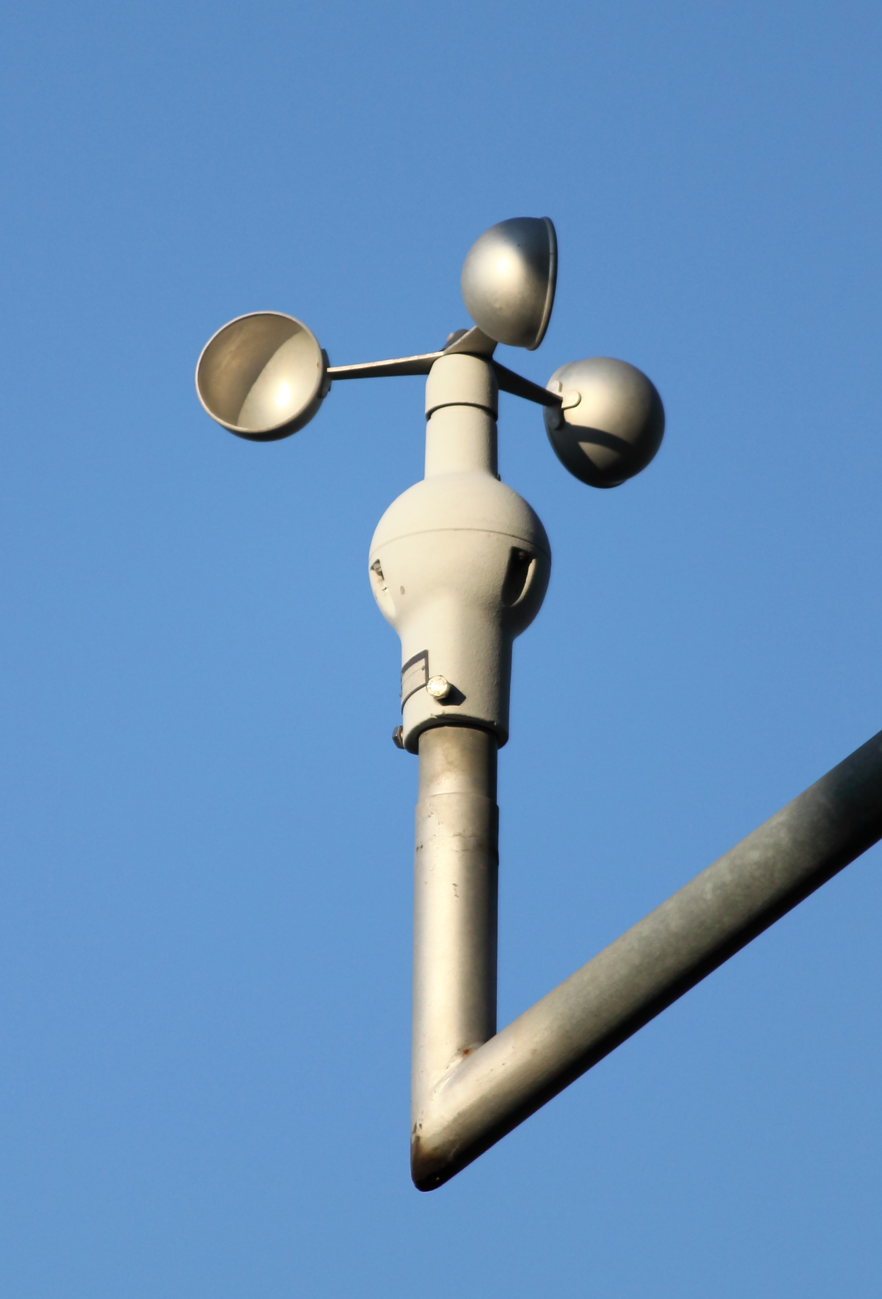 Anemometer
|
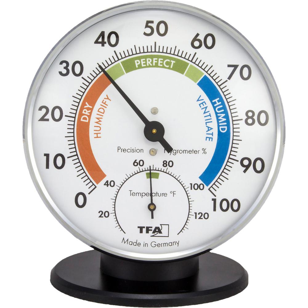
| Hygrometers: Hygrometers measure humidity,(amount of water vapor) in the air. It is measured as a percentage of how much water is in the air at a given time versus how much water vapor the air can hold at maximum. At one hundred percent, the water vapor will condense back into liquid water and become rain. |
 |
| Rain Gauges: Rain gauges measure the amount of rain that has fallen over a specific time period. The measuring tube catches rainfall and must be emptied out between recordings for accuracy. |
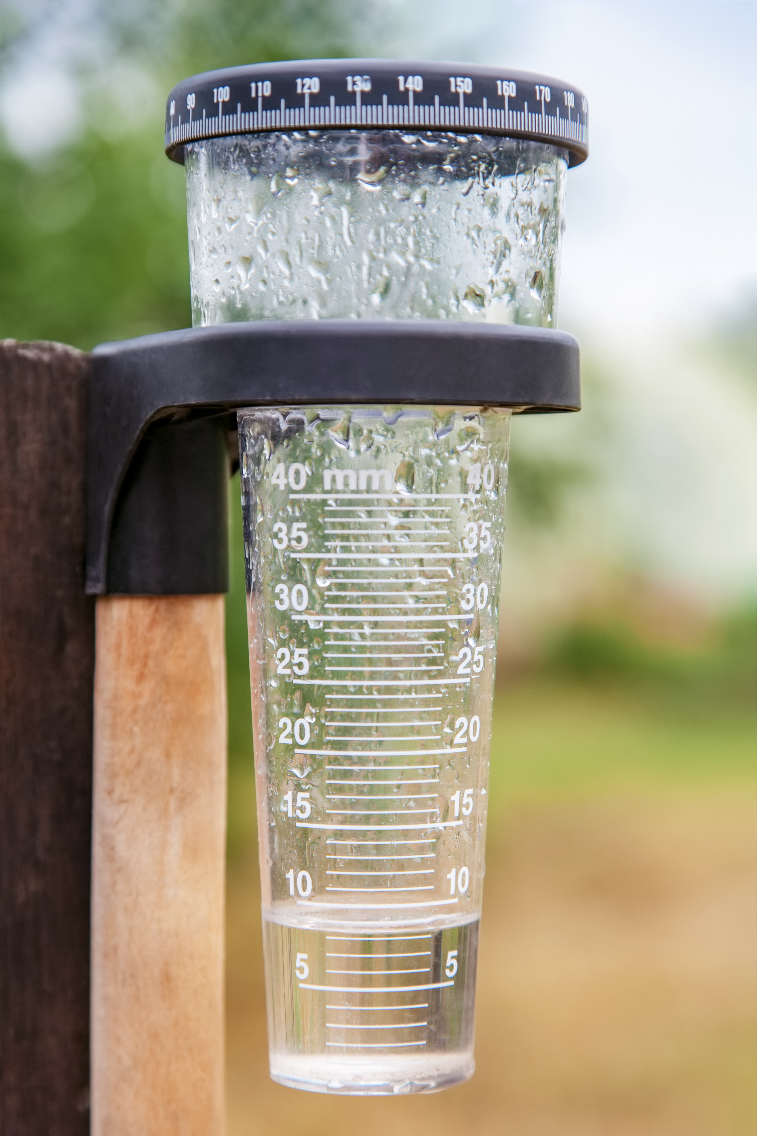 Rain Gauge
|
|
Barometers:
Barometers measure air pressure in the atmosphere, also called barometric pressure. The layers of air around Earth make up our atmosphere. The air has a weight and presses against everything it touches, including a barometer. The barometer reads pressure changes which allows meteorologists to predict short-term weather changes. If the pressure drops, you can expect wind, clouds, and rain. If pressure increases, you can expect clear skies and cool, dry air. |
|
| Wind Sock:
A wind sock is a cone-shaped tube of fabric, which resembles a giant sock, attached to pole that rotates. It helps us determine wind direction and relative wind speed. When wind blows, it fills the sock. Use the cardinal directions sign in your outdoor classroom along with your wind sock to determine the direction the wind is blowing. |
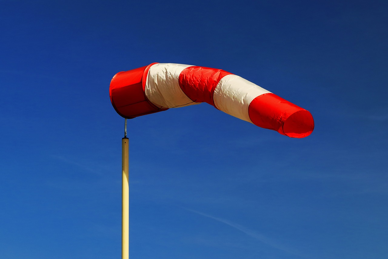 Wind Sock
|
|
Cirrus:
|
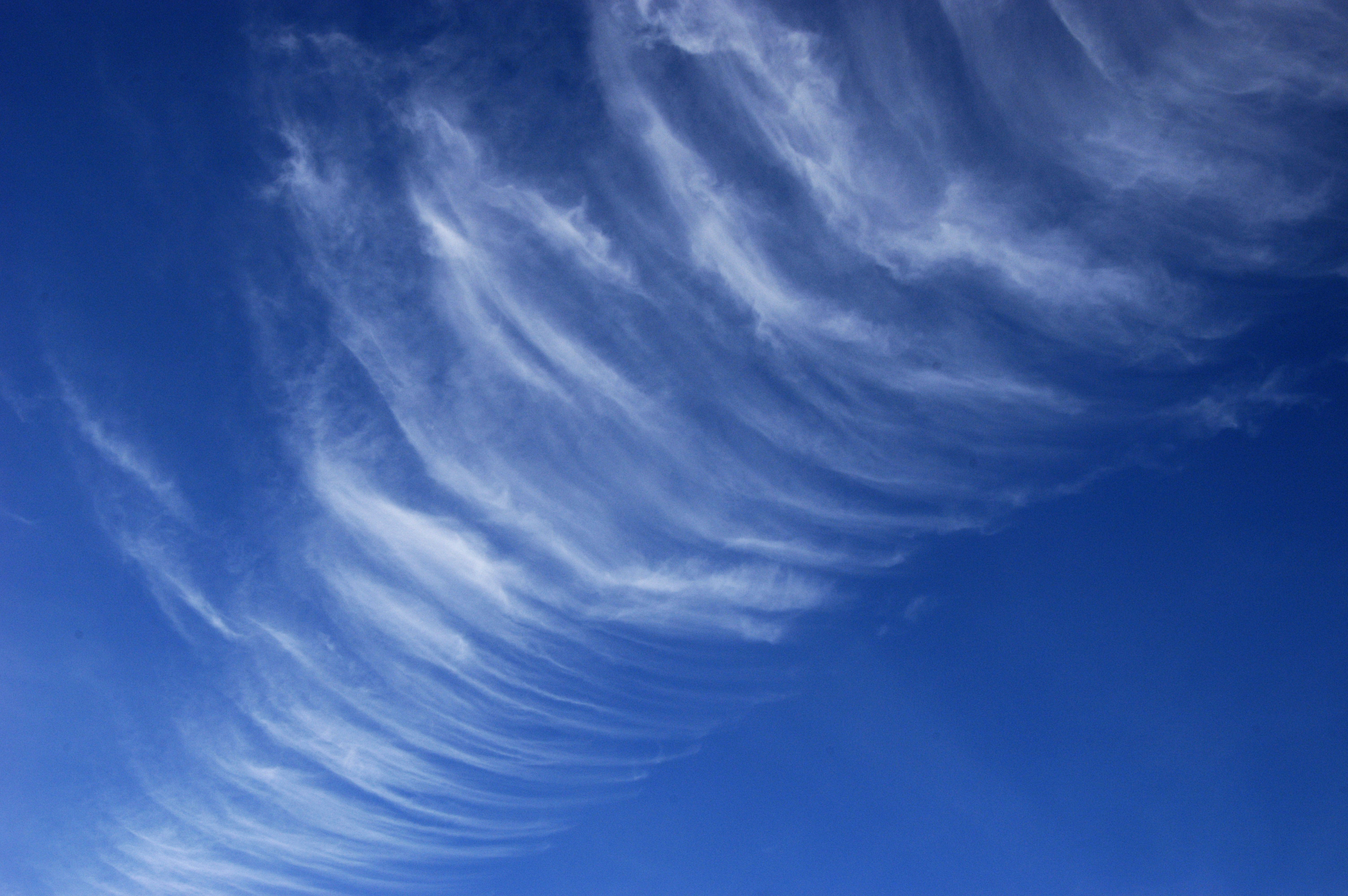 Wikimedia - Simon A. Eugster Click on image to enlarge it |
|
|
Cirrostratus:
|
 Flickr - Gexydaf Click on image to enlarge it |
|
|
Cirrocumulus:
|
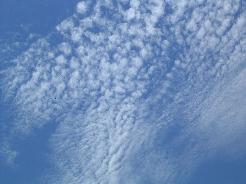 Wikimedia - Simon Eugster Click on image to enlarge it |
|
|
Altostratus:
|
 Wikimedia - The Great Cloudwatcher Click on image to enlarge it |
|
|
Altocumulus:
|
 Wikimedia - farmartin Click on image to enlarge it |
|
|
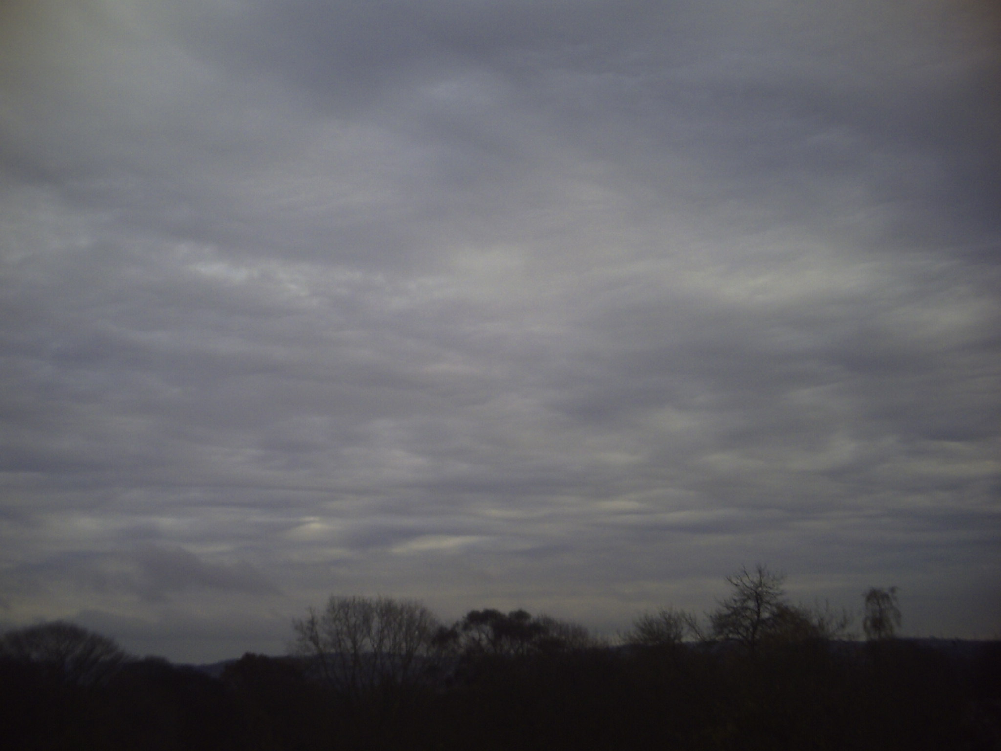
Stratus:
|
 Wikimedia - The Great Cloudwatcher Click on image to enlarge it |
|
|
Stratocumulus:
|
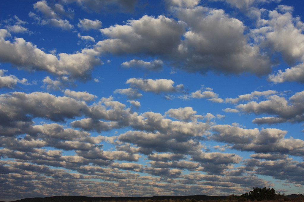 Flickr - J.N. Stuart Click on image to enlarge it |
|
|
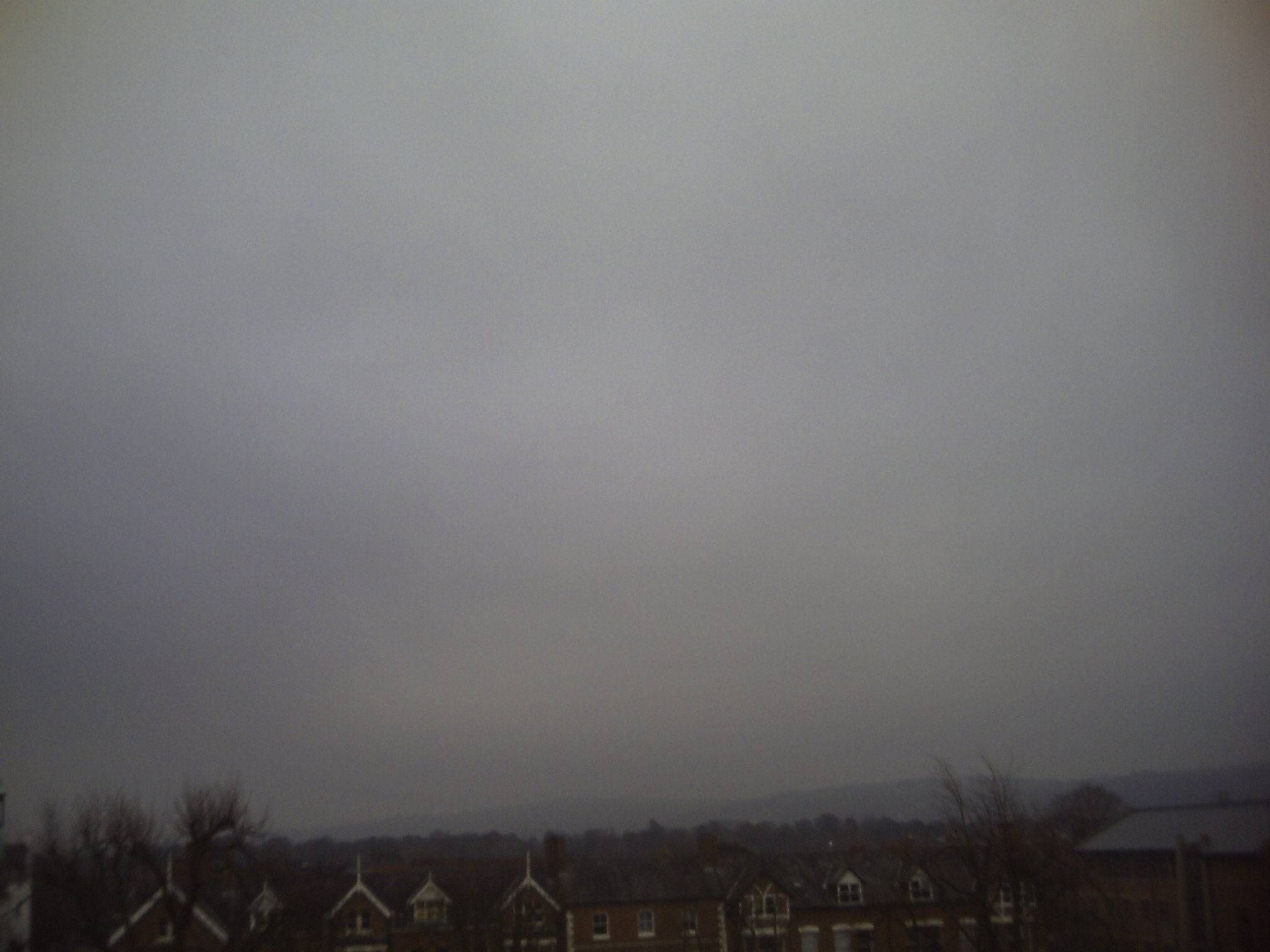
Nimbostratus:
|
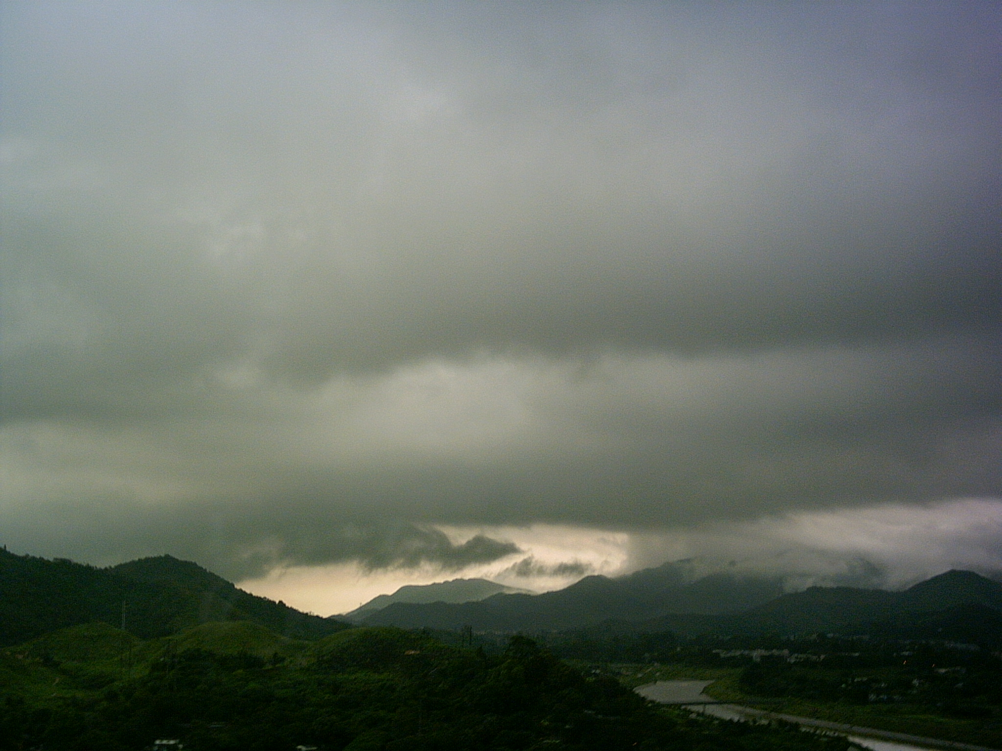 Wikimedia Click on image to enlarge it |
|
|
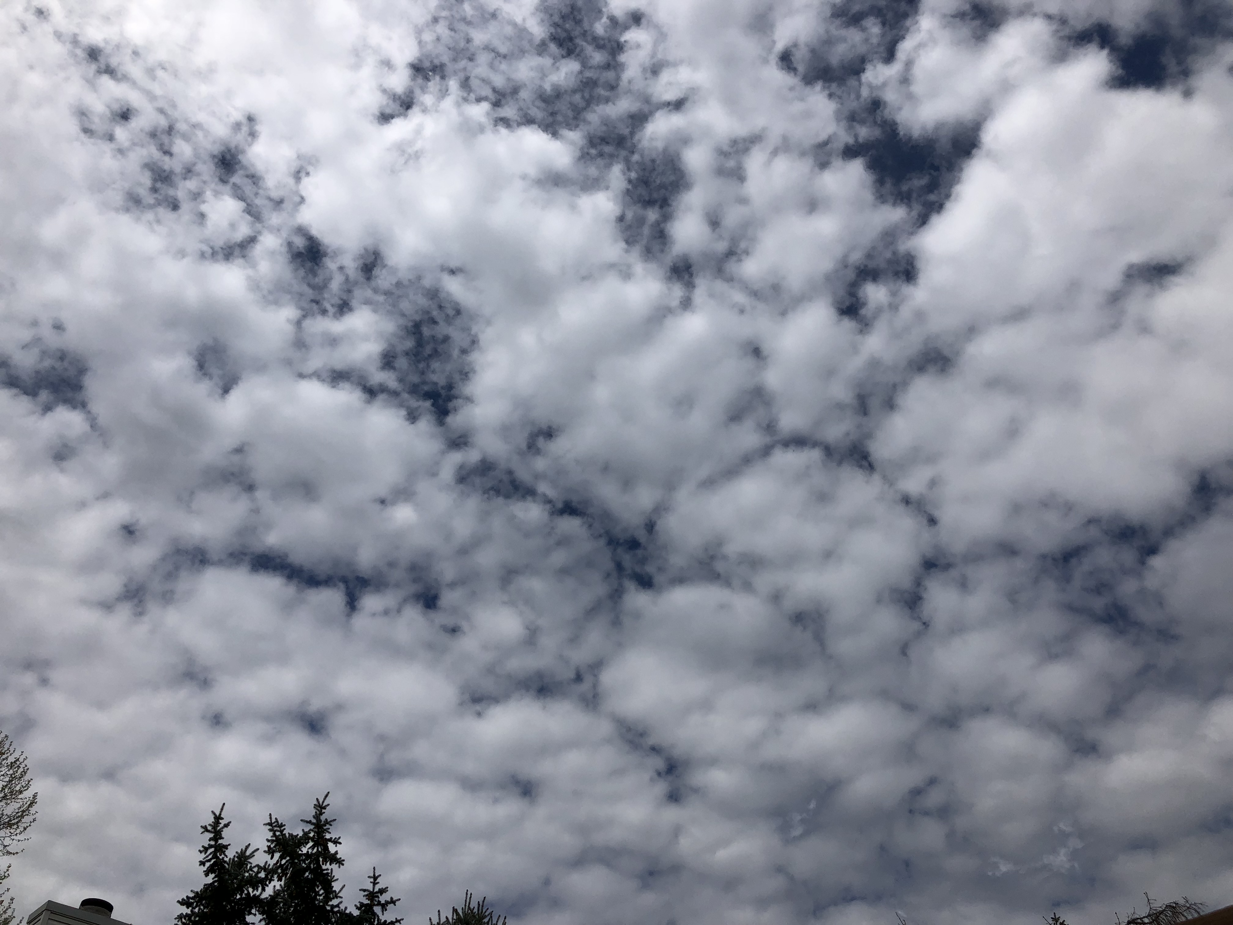
Cumulus:
|
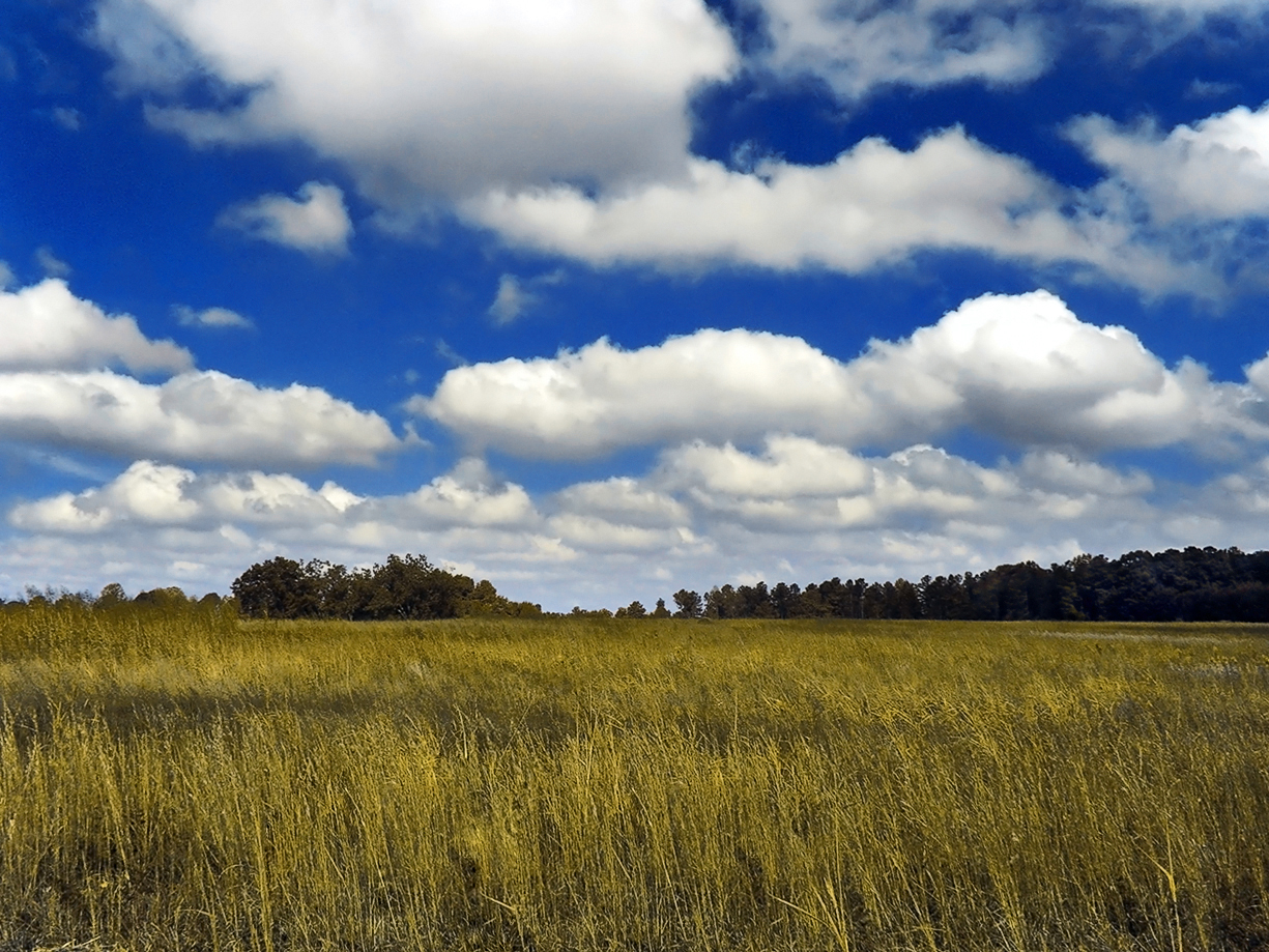 Wikimedia - PiccoloNamek Click on image to enlarge it |
|
|
Cumulonimbus:
|
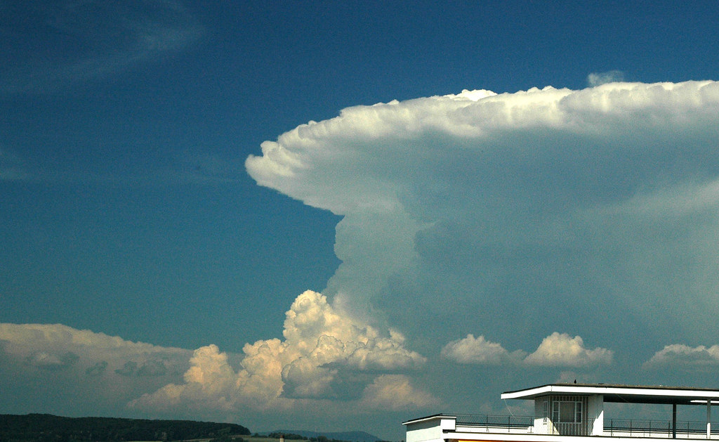 Flickr - Andreas Christen Click on image to enlarge it |
|
SOURCES
|
|
.