 Wildlife Tag
Upper Grades Ecosystem Investigation: Alabama's Waterways
 Investigate Alabama's Waterways
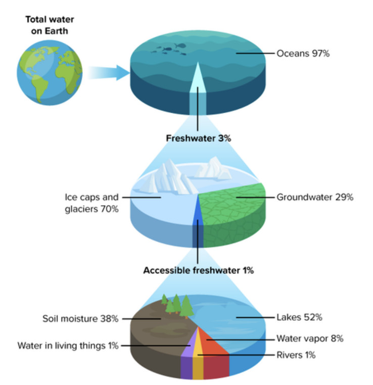 |
| Distribution of Water on Earth CK-12 Foundation Click image to enlarge it |
Roughly 70% of Earth's surface is covered with water. 97% of the water on Earth is saltwater, found in oceans and seas. Only 3% is freshwater. Most of that freshwater is found frozen in glaciers, ice caps, or deep underground in aquifers (rock or sediment saturated with water). Only one-third of that freshwater (or 1% of all water on Earth) is usable by humans to meet our needs. It is found in rivers, lakes, soil, the atmosphere, and within organisms. It is replenished by precipitation (rain, sleet, snow).
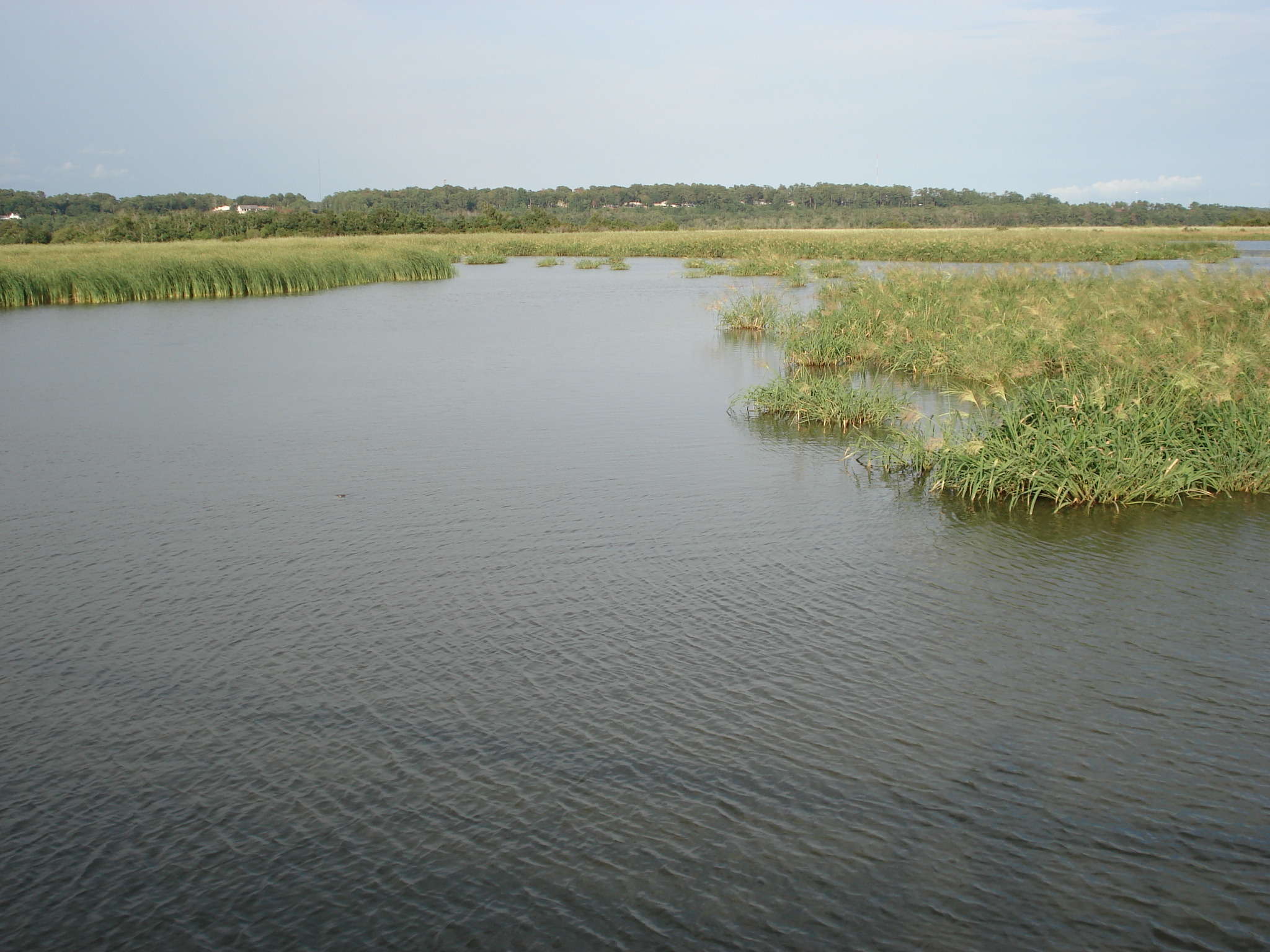
Alabama is one of the top ranked states for freshwater habitats and resources. Alabama has more navigable stream miles than any other state and is ranked 7th in the country for its amount of stream miles. Freshwater habitats including rivers, streams, lakes, marshes, bogs, and estuaries provide the state with unique habitats. Alabama's unique geological features and abundant freshwater ecosystems allow for a high level of biodiversity (the variety of living things in an area) in the state.
| Click on the topics below to learn more! | |||
 |
|
 |
 |
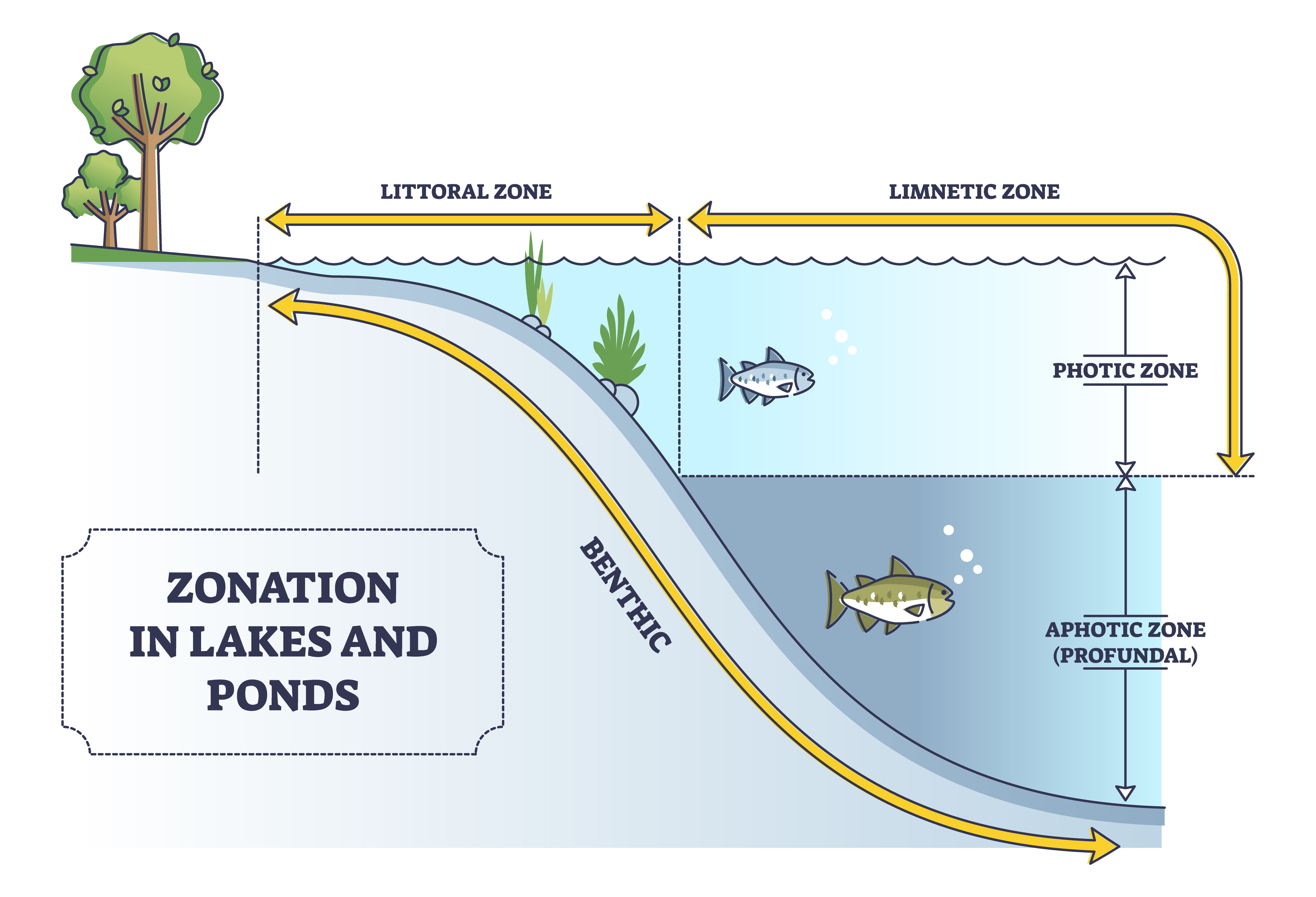
| Watersheds | Rivers and Streams | Lakes and Ponds | Additional Habitats |
| Watersheds | ||
| What is a watershed? | ||
| A watershed, also called a drainage basin, is an area of land through which rainwater drains by flowing across, through, or under the soil surface to a common low point (definition from ACES). Every body of water has a watershed. It may drain into a larger stream, lake, wetland, estuary, or ocean. A watershed includes the land, air, water, and living things in that location. Different watersheds are separated by locations that are higher in elevation, called ridges. Smaller watersheds separated by lower ridges can be contained within larger, major watersheds. |
||
| At the highest point, water begins to flow downhill, eventually collecting in streams. These initial (1st order) streams will join additional streams, and these larger streams will eventually connect with major rivers or lakes. Ground water, water found in spaces between soil particles underground, also moves downwards towards the nearest outlet such as a stream or spring. "We all live and work in a watershed, as all land is part of a watershed. Your everyday actions (work, play, and general living) can impact (positively or negatively) the quality of water that flows from your watershed. As water flows through the system, the impacts are cumulative. This means that everything you do on the land can impact the water that flows to your downstream neighbors. Likewise, everything that landowners above you do impacts the quality and quantity of what flows across your land." (Quote from ACES) |
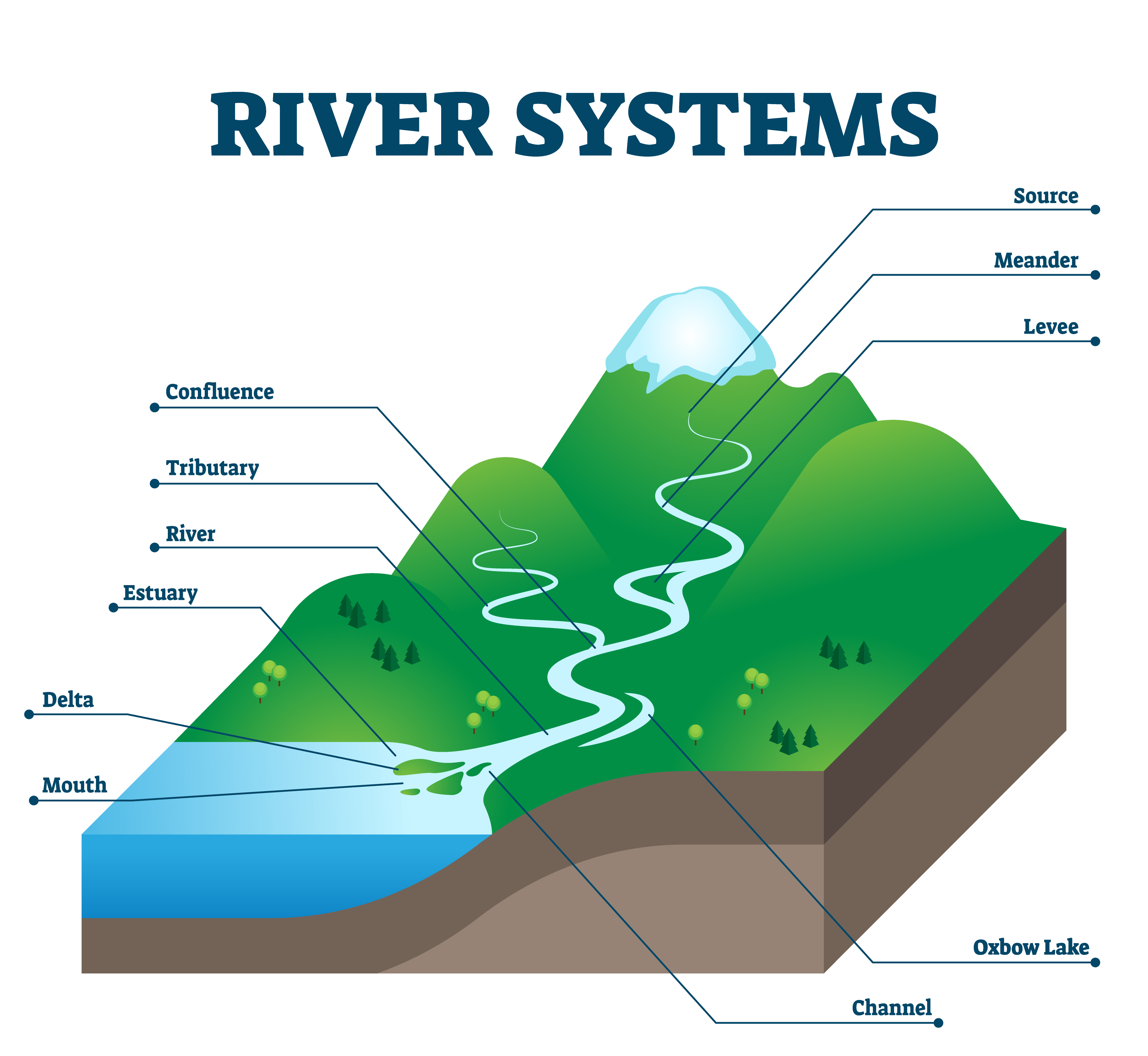 Diagram of a Watershed
Dreamstime Click image to enlarge it |
|
| Watersheds in Alabama: | ||
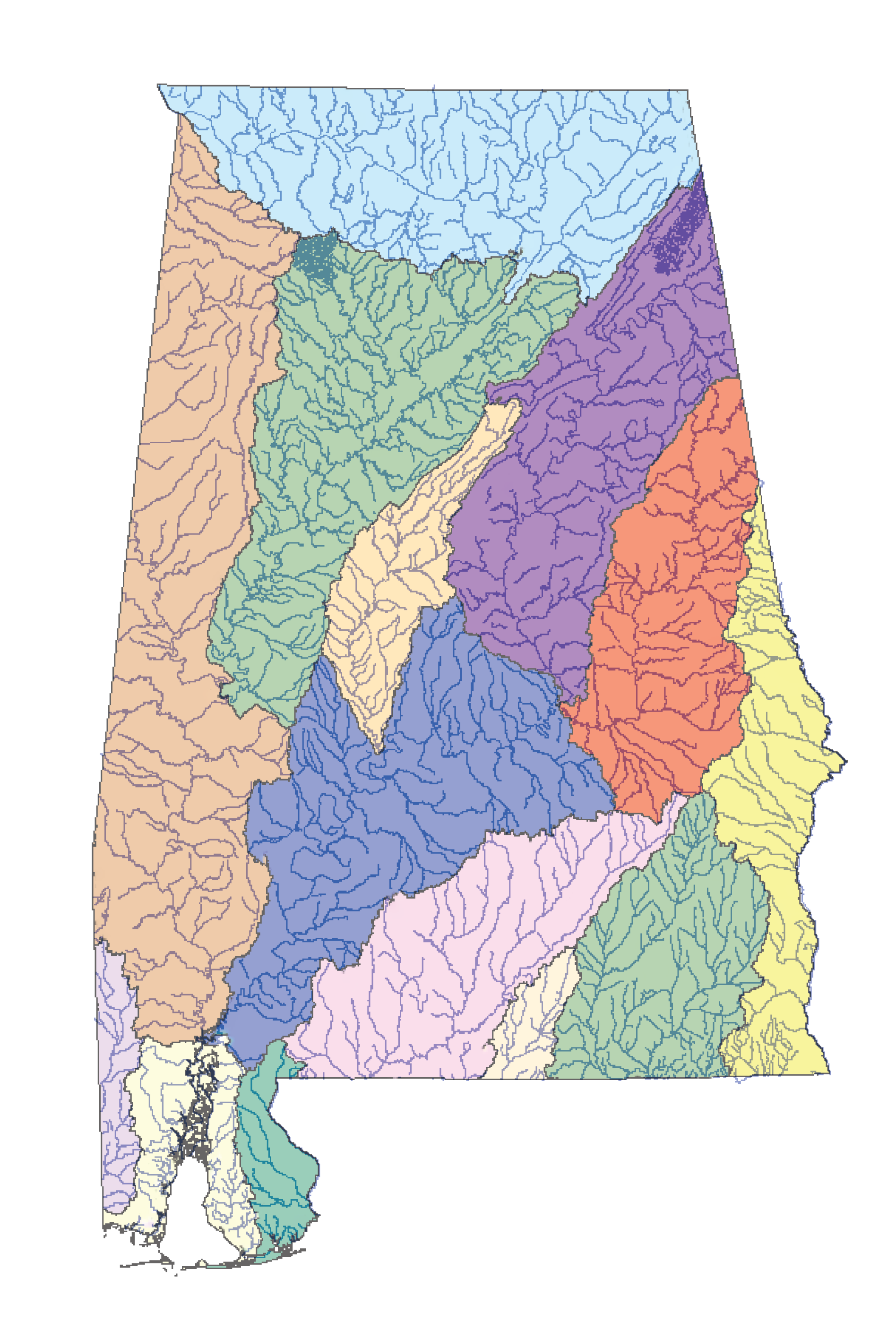
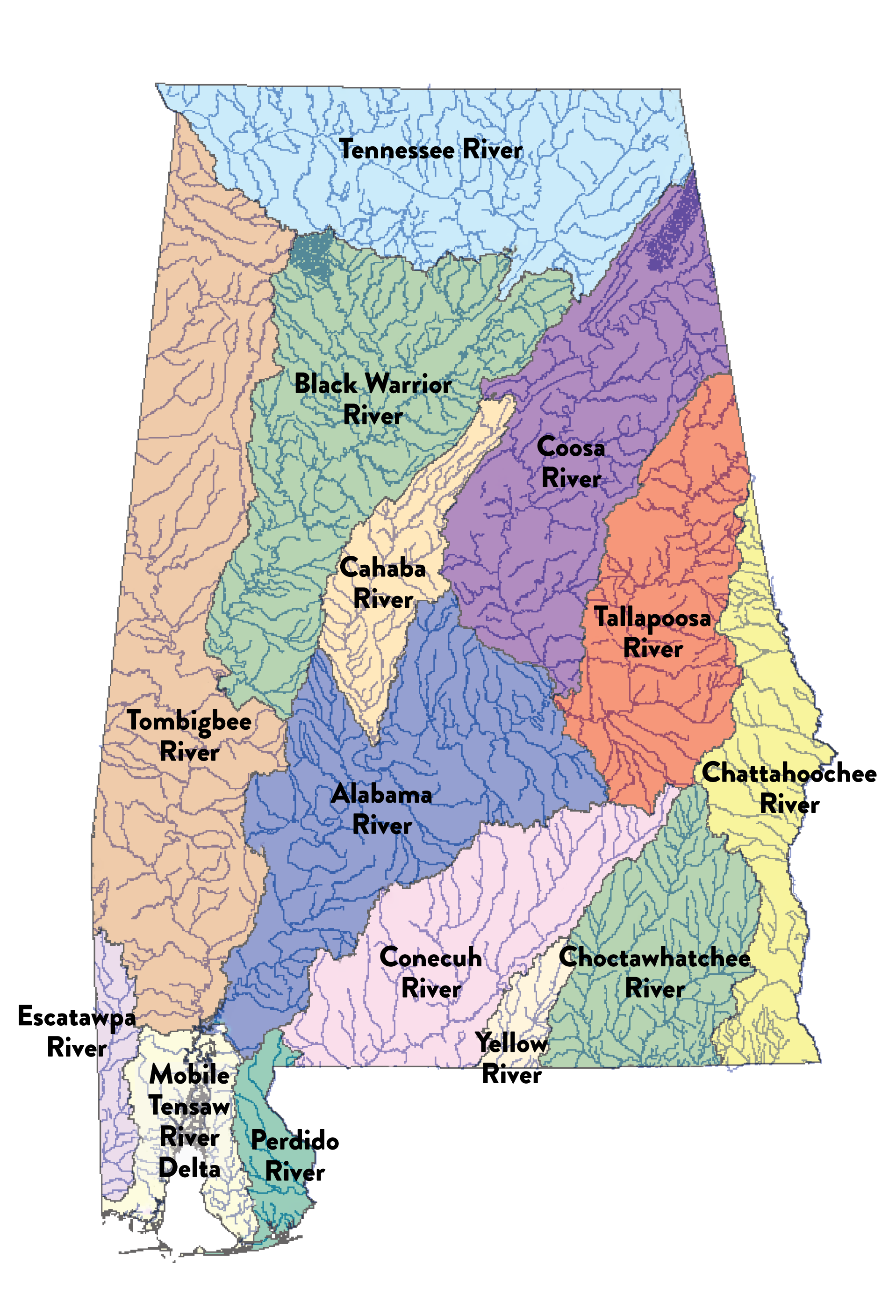
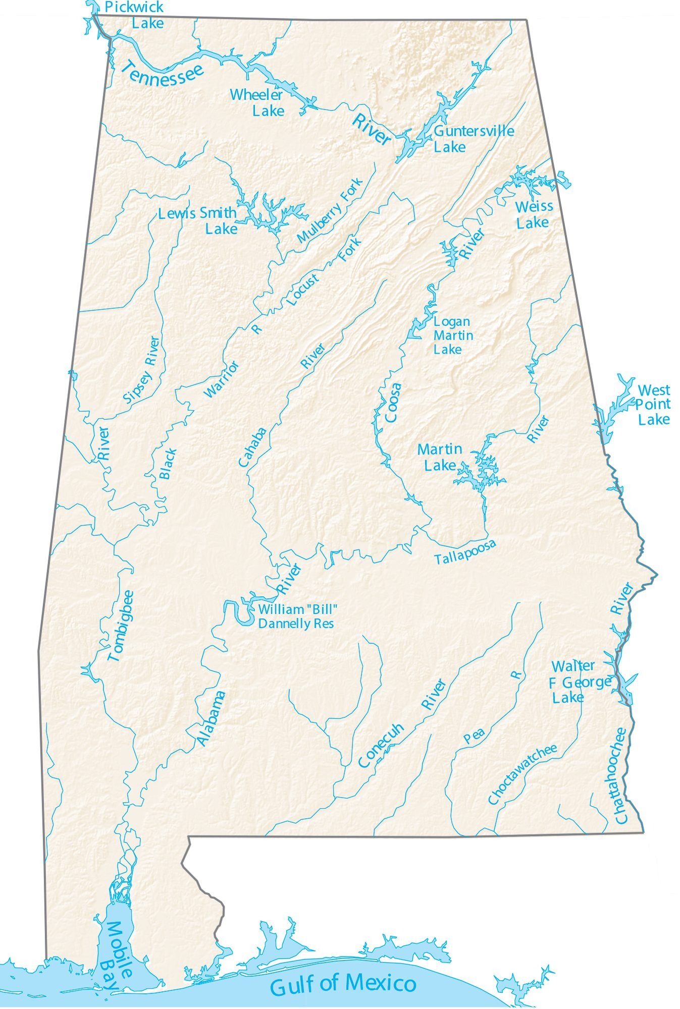
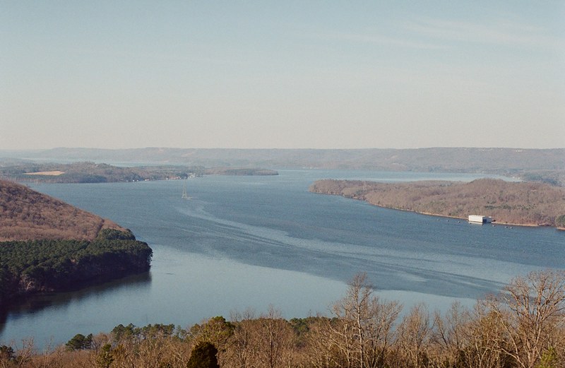
| Alabama has several smaller watersheds within three broad areas: the Tennessee River drainage in the northern part of the state, the Mobile River Basin in the central part of the state, and the Coastal Drainages in the southern part of the state. The Tennessee River drains about 13% of Alabama's land area. This drainage area contains the Tennessee River as well as Pickwick Lake, Wilson Lake, Wheeler Lake, and Lake Guntersville. The Mobile River Basin drains about 63% of Alabama's land area. It contains the upper Tombigbee River, Black Warrior River, lower Tombigbee River, Cahaba River, Coosa River, and Tallapoosa River. Lake Martin, Weiss Lake, and Smith Lake are located in this drainage area. The Coastal Drainage area in south Alabama contains smaller river basins that empty into the Gulf of Mexico. |
||
 |
 |
|
| Learn about your watershed: | ||
| Click here to learn more about specific watersheds in Alabama! Click here to see how water flows when it lands in a specific location! |
||
| Rivers and Streams | ||
| River Formation: | ||
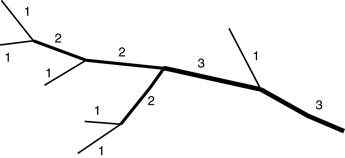
| When precipitation falls, water runoff flows downhill and begins collecting in channels called streams. The initial channels that form are called headwater streams or 1st order streams. When two 1st order streams join, a 2nd order stream is formed. When a 2nd order stream meets another stream, a 3rd order stream is formed. A river is a larger stream of water that flows through a channel towards the sea. Smaller streams that flow into major rivers are called tributaries. |
 Wikimedia - Langlaufer Click image to enlarge it |
|
| Stream Habitats: | ||
| Different parts of streams and rivers provide different habitats for aquatic wildlife. The headwaters of a stream are often very different from where a river meets the ocean or a lake. Headwaters often flow quickly through shallow channels in the steep terrain. Farther downstream, the gradient is less steep, and waters tend to flow more slowly in deeper channels. Sections within a single stream are often different from one another. Areas where streams are more shallow and tend to flow faster, often over rocks, are called riffles. An area of a stream that flows smoothly is called a run, and deep areas where water moves slowly and deposits fine sediment are called pools. Different aquatic organisms are specifically adapted for these different microhabitats (smaller unique habitat within a larger habitat or ecosystem). |
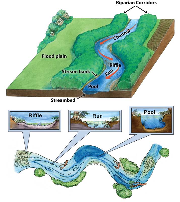 Parts of a Stream
Missouri Department of Conservation, Texas Parks and Wildlife Department, The Meadows Center for Water and the Environment, Rudolph Rosen Click image to enlarge it |
|
| The stream bottom provides habitat for benthic organisms (organisms that live on or under the ground layer beneath a stream). Some streams have a rocky surface underneath, some have sandy bottoms, and some have areas with fine particles. Each of these materials provides a different type of habitat suitable for different aquatic organisms. A riparian zone is an area directly next to a stream including the floodplain (where water can overflow). Many living things are specifically adapted to live in these types of areas. |
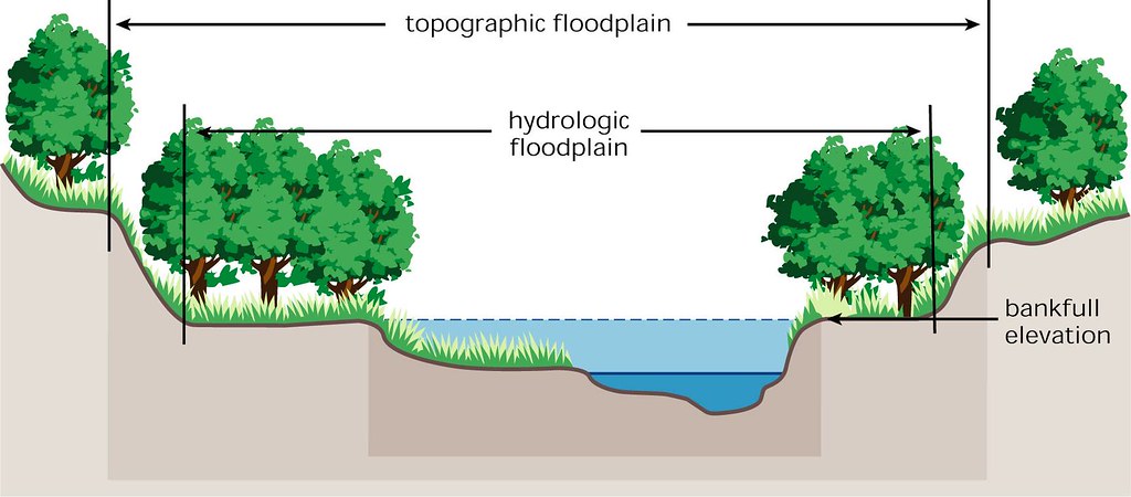 Floodplain Diagram
flickr - placeuvm Click image to enlarge it |
|
| Alabama Rivers: | ||
| The diverse geology of Alabama leads to a variety of rivers and streams that are noticeably different depending on the location in the state. The rivers and streams in the northern part of the state tend to have faster flowing areas over metamorphic rock that is not easily weathered. These rocky bottomed streams are characterized by having clear water with shallow areas of elevation change providing a rapid effect. |
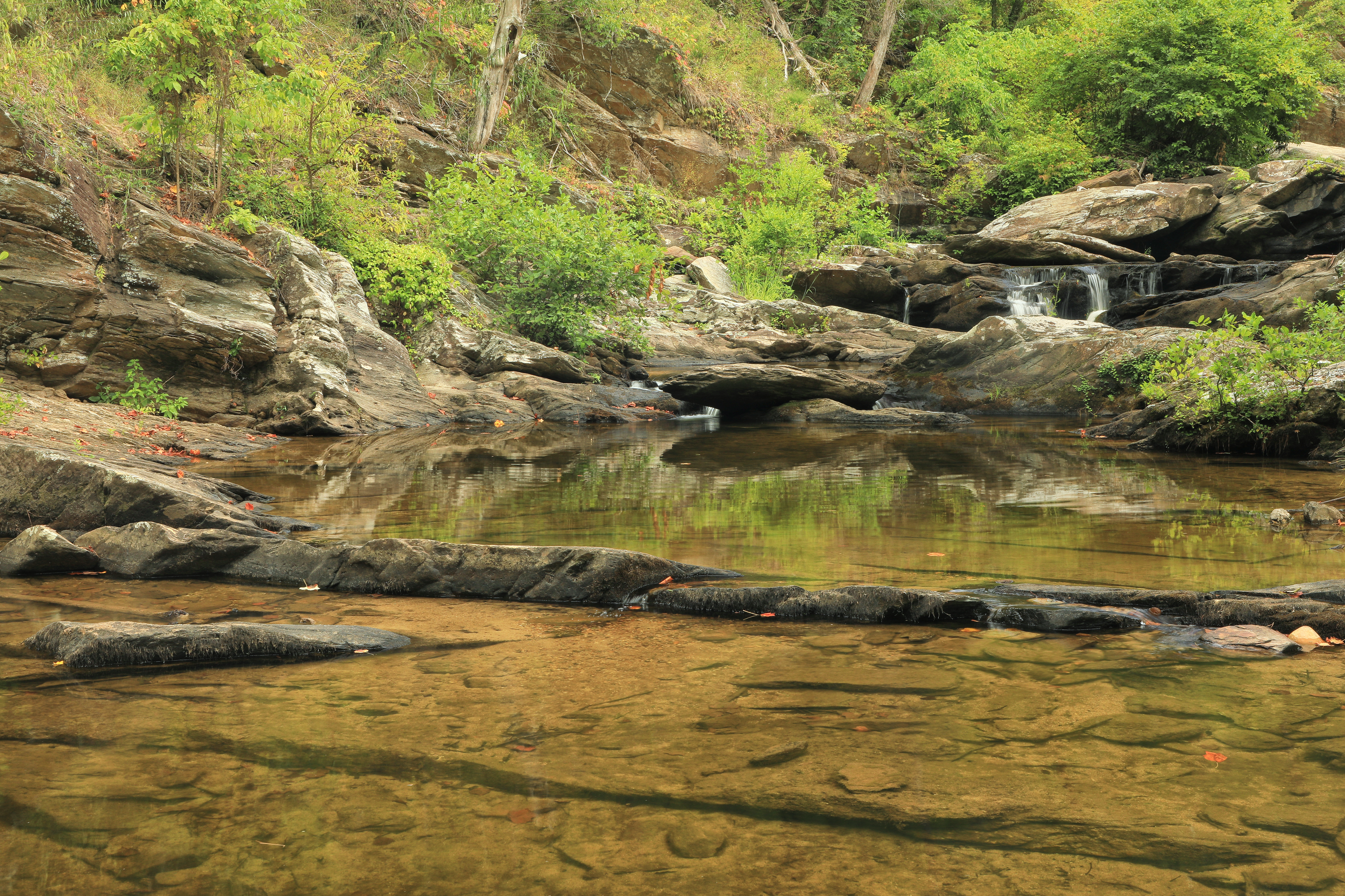 Cheaha Creek, Cheaha Creek Gorge, Clay Co. AL
photograph by Alan Cressler Click image to enlarge it |
|
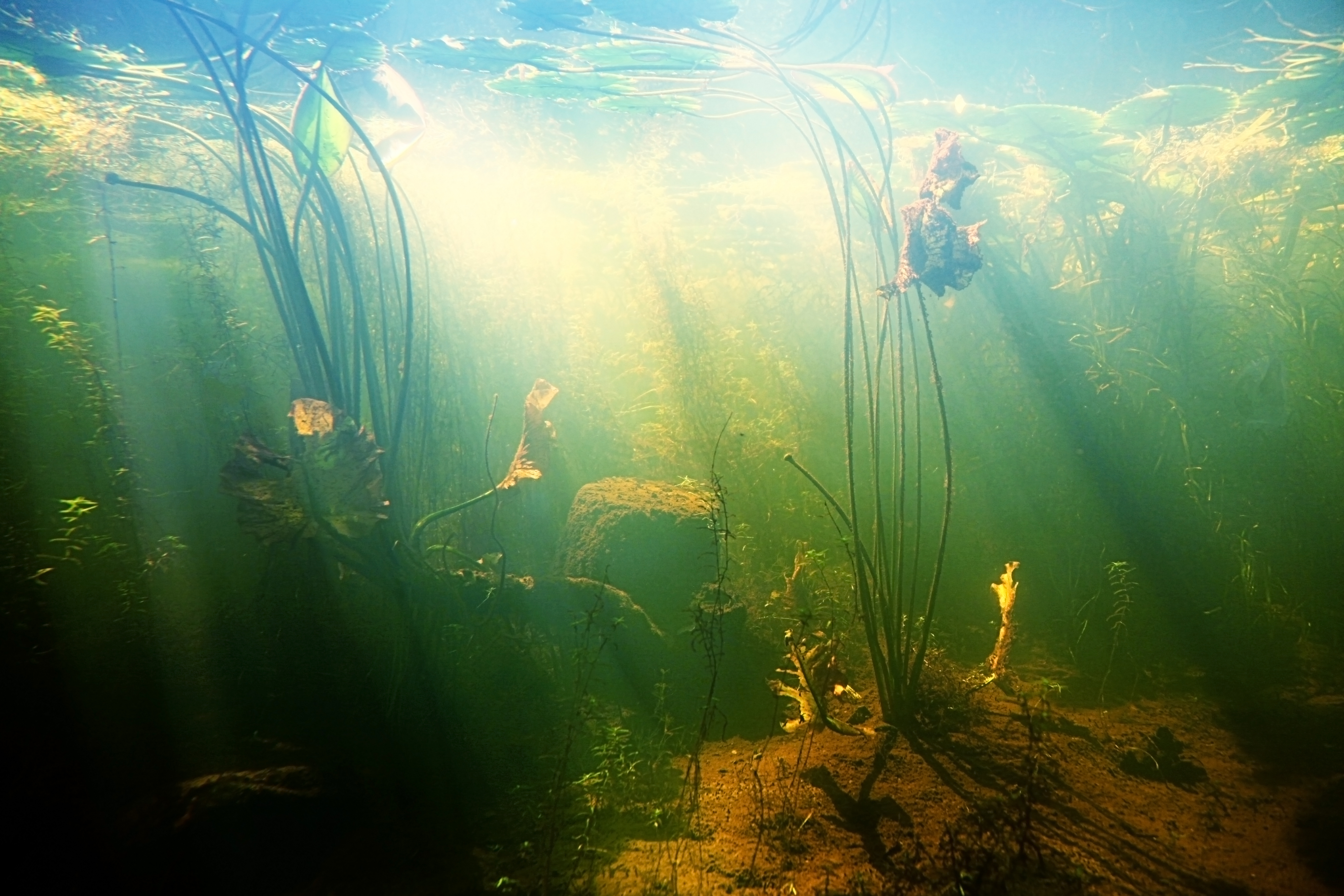
| As some of these streams connect further south in the state, the channels begin to widen while the slope of the land begins to decrease. Streams in the southeastern plain ecoregion are often more wide and slow moving with sandy bottoms. In the coastal plain ecoregion, rivers move slowly through wetland or swamp areas surrounded by forests. As vegetation decays in and around the slow moving water, tannins are released, staining the water, giving them a dark appearance. These blackwater streams and rivers are characteristic of the southern part of the state. |
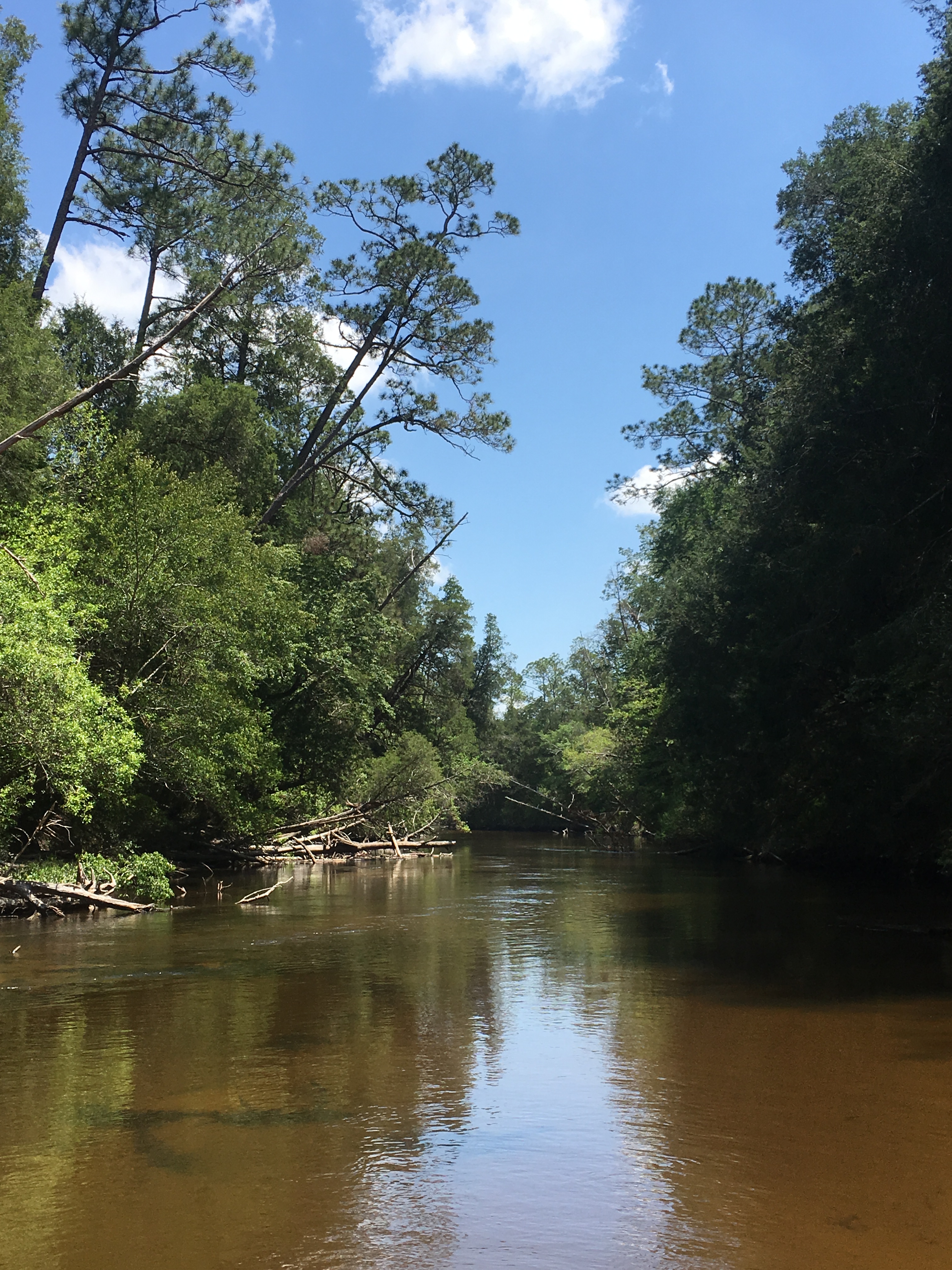 Perdido River, Perdido Watershed in the Southeastern Plains Ecoregion
flickr - FWC Fish and Wildlife Research Institute Click image to enlarge it |
|
Many of Alabama's rivers and streams are known for their high diversity of freshwater fishes and snails.
|
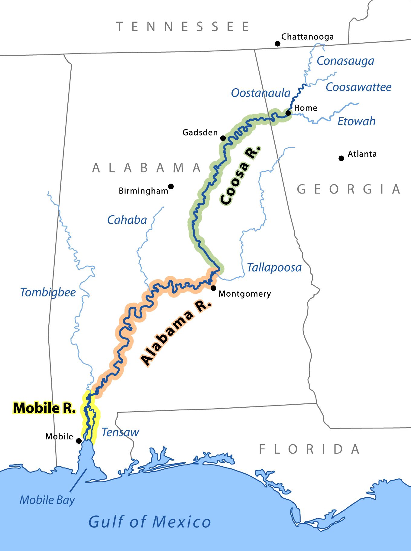 Major Rivers in Alabama
Wikimedia - pfly and John Lambert Click image to enlarge it |
|
SOURCES USED FOR THIS PAGE:
|
|
 |
|
|
|
|
|
|
|
|
|
 |
||