Upper Grades Ecosystem Investigation: Alabama's Ecoregions
 Investigate Alabama's Ecoregions
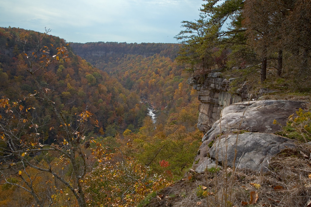 |
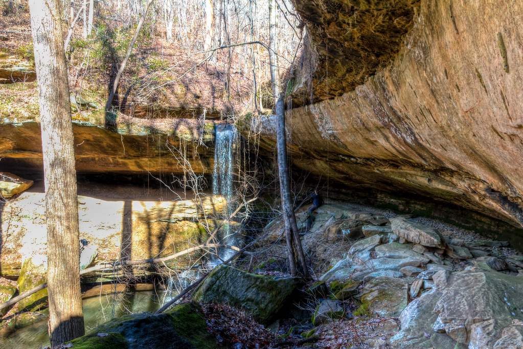
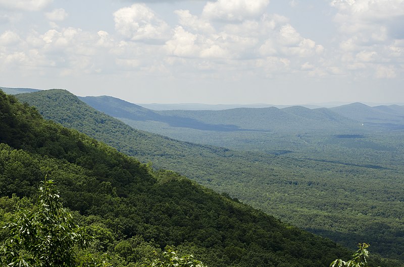
Little River Canyon
flickr - Alby Headrick
Click on image to enlarge it
|
An ecoregion is a major ecosystem defined by its distinct geographic region and environmental conditions such as solar radiation and moisture and its natural communities.
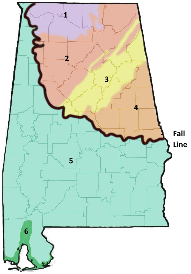
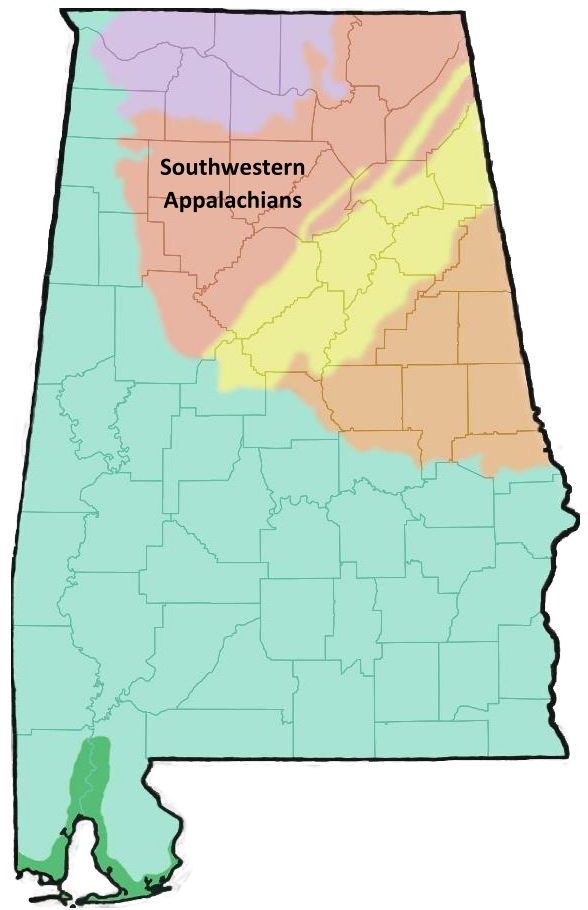
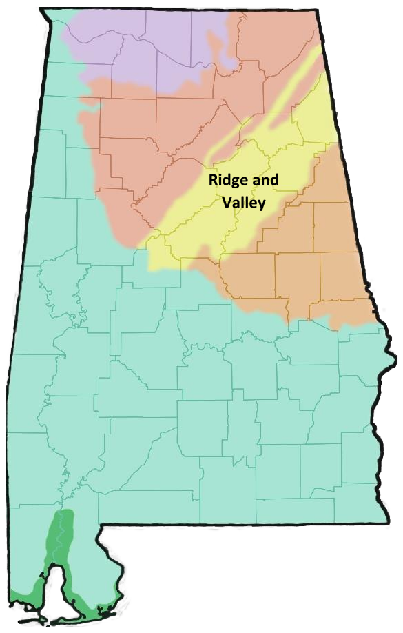
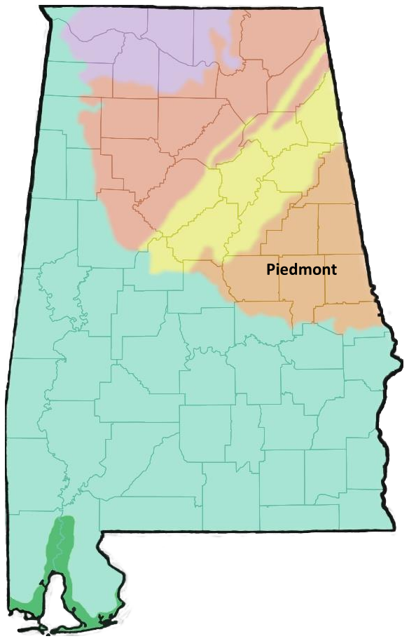
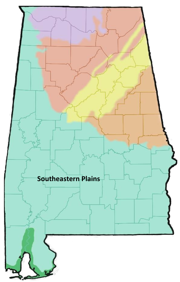
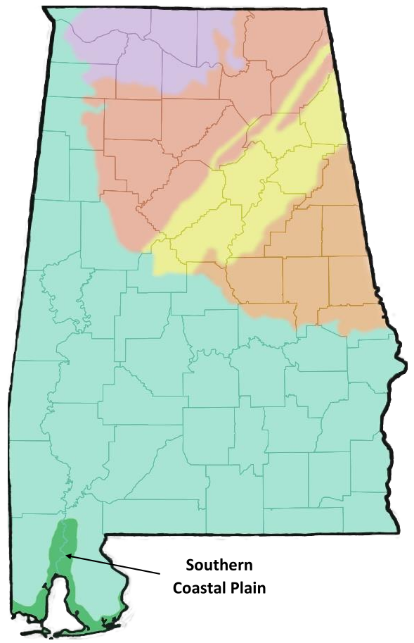
Alabama contains a diverse set of geographic features including ridges and valleys, Appalachian foothills, cave systems, rivers, lakes, swamps, flat plains, and coastal habitats. The more mountainous regions in the northeastern part of the state are separated from flat plains in the southern part of the state by the fall line. The fall line is a visible geographic feature characterized by a change in elevation and rock structure. The diversity in the geographic features of Alabama has resulted in a high diversity of species in the state. Alabama has 6 distinct ecoregions, each characterized by a set of physical characteristics and biological communities.
To explore more ecosystems and biomes across the world, visit The Wild Classroom's Explore Biomes page or NASA Earth Observatory's Mission: Biomes page.
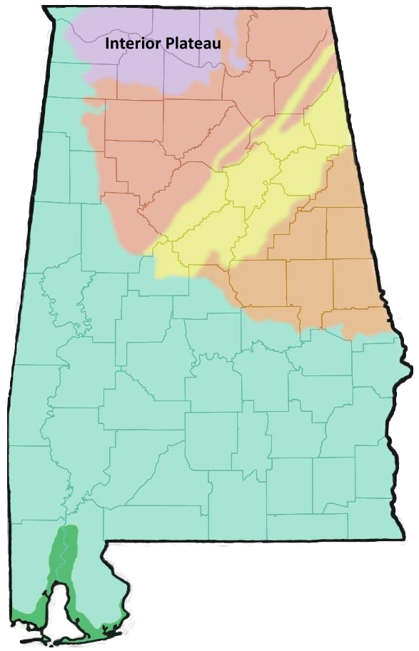
| Interior Plateau |
| |
|
|
| Description: |
|
|
- Also called the Highland Rim region
- Northernmost ecoregion in Alabama
- Elevation ranges from 420 to 900 feet and is lower than the Appalachian ecoregions of Alabama
- Tennessee River runs through this ecoregion
- Characterized by flat plains with some hills
- Deeper valleys along larger streams or where limestone has been eroded away
- Rock cliffs in this region are some of the oldest in Alabama
|
|
| |
|
|
| Geology: |
|
|
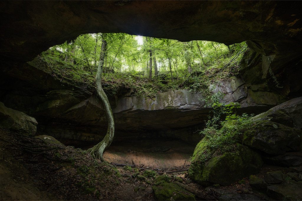
- This region's rocks are primarily limestone, sandstone, and shale
- Limestone erosion leads to rich, red soils
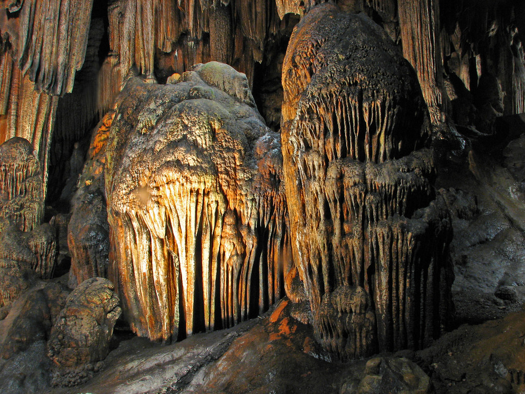
- Limestone erosion also leads to a karst landscape (one in which limestone underneath has eroded away, forming caves, ridges, and sinkholes)
|
|
The Tennessee River Valley plays an important role in Alabama's agricultural crops including cotton, corn, and soybeans. The rich red, soils created from erosion of limestone is beneficial for growing these crops. |
|
| |
|
|
| Habitats: |
|
|
- Forests are mostly oak-hickory
- Includes areas with shallow soil where limestone bedrock can be exposed forms cedar glades
- Praries of little bluestem
- Other habitats include springs, sinks, seeps, caves, and rock shelters
|
Geology Freatures at Cane Creek Nature Preserve
flickr - Michael Hicks
Click on image to enlarge it
|
| |
|
|
| Notable Landmarks and Species: |
|
|
|
|
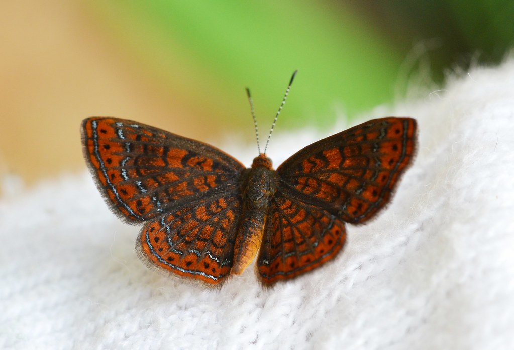
Swamp Metalmark
flickr - Andy Reago & Chrissy McClarren
Click on image to enlarge it
|
| |
|
|
| Southwestern Appalachians |
| |
|
|
| Description: |
|
|
- Also called the Cumberland Plateau region
- Landscape described as low mountains
- Flat topped plateaus with higher elevations are separated by either steep cliffs or more gradual valleys
- Elevation ranges from 500 feet in the southwest region up to 1,800 feet in the northeast section
- Characterized by more precipitation than other ecoregions and lower annual temperatures than surrounding ecoregions
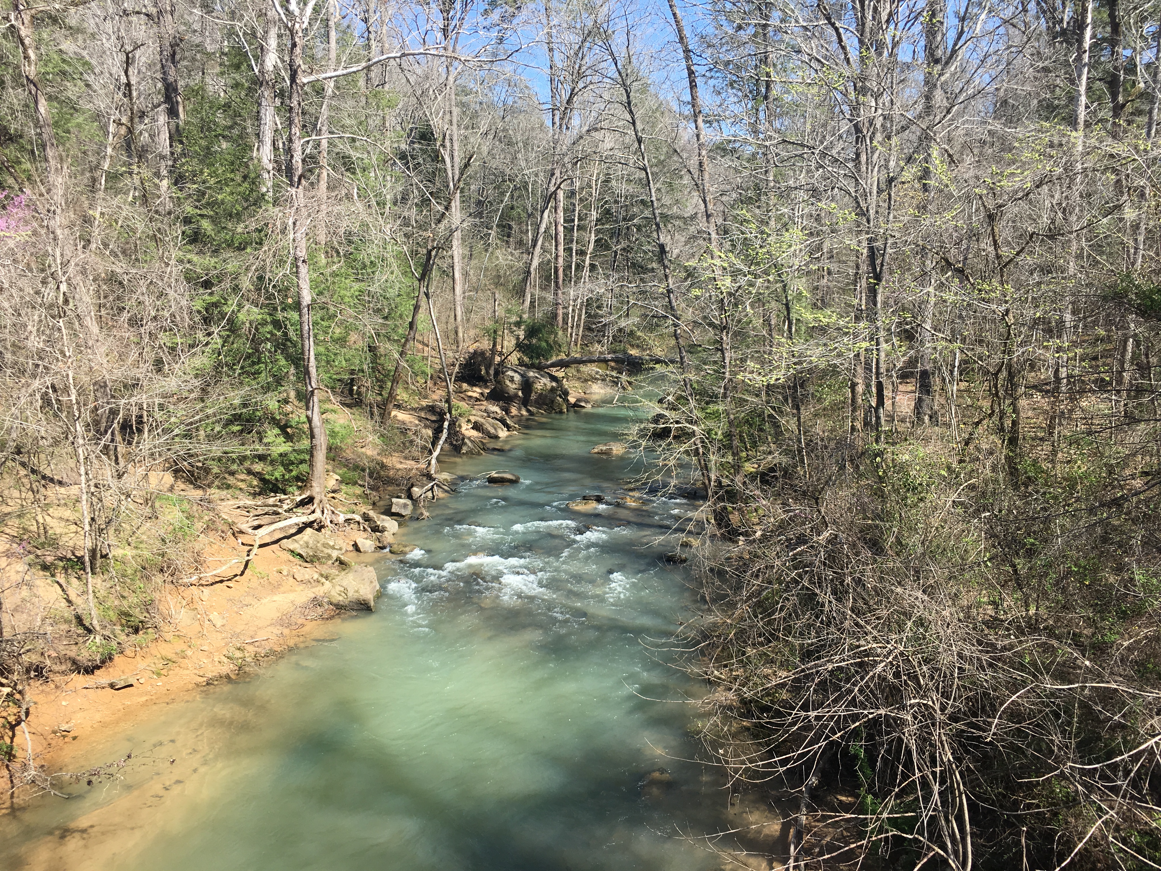
- The northeast portion contains steep-sloped forests and streams
|
|
| |
|
|
| Geology: |
|
|
- Northeast region contains sandstone, siltstone, shale, and conglomerate (smaller sized rocks held together by a natural "cement")
- The central portion of this region is composed of rocks that contain layers of coal
- The southwest region has more shale and less sandstone than the other portions of this region
- Landforms are created as a result of erosion
- Sandstone is resistant to erosion
- Streams have carved valleys in softter limestone and dolomite rocks
|
Bankhead National Forest
flickr - Outdoor Alabama - Keith Bozeman
Click on image to enlarge it
|
| |
|
|
| Habitats: |
|
|
- Habitats in this ecoregion contain well-drained and acidic soils
- Areas of higher elevations have mostly mixed oak forests
- Forests in valleys and gorges include American beech, tulip poplar, sugar maple, and buckeye
|
Little River Canyon
flickr - Alby Headrick
Click on image to enlarge it
|
| Notable Landmarks: |
|
|
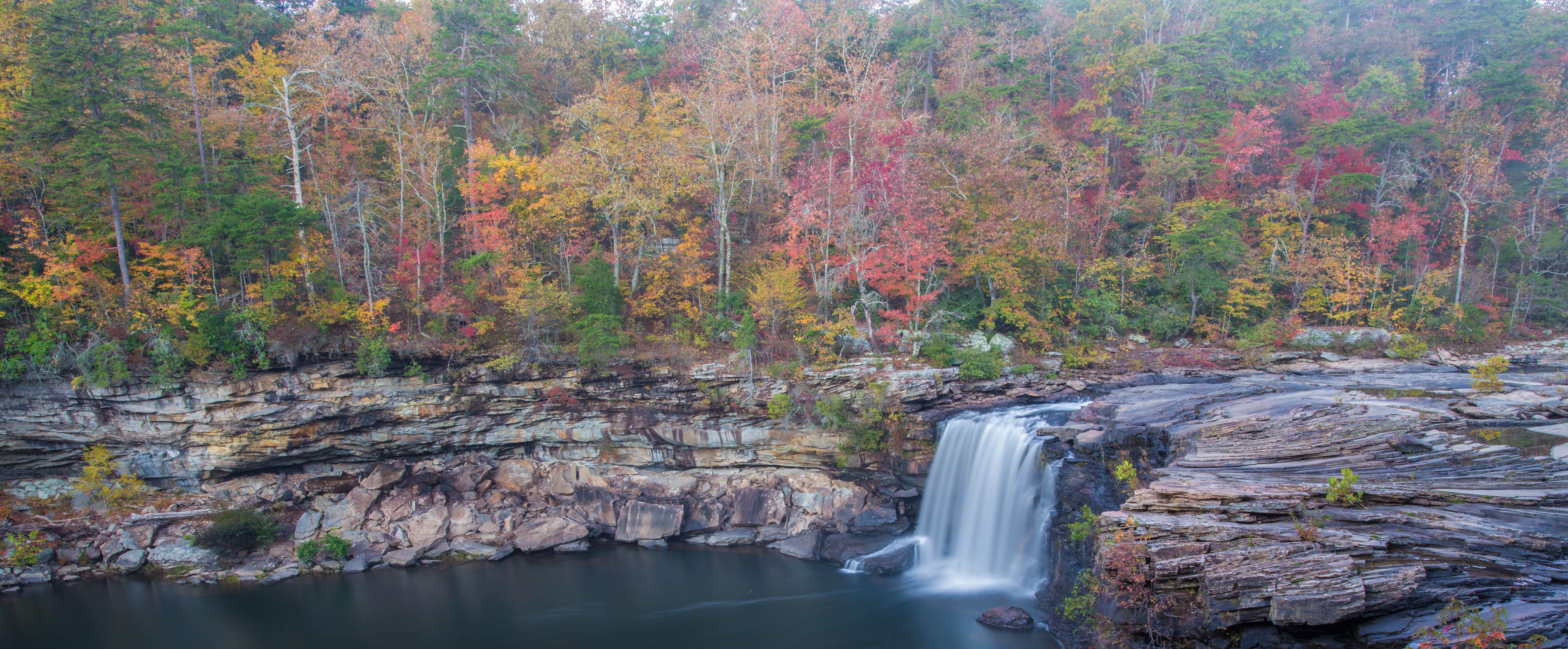
- Little River Canyon in Fort Payne
- Largest canyon in the eastern United States
- Tall sandstone canyon walls surround large waterfalls
|
Little River Canyon
Wikimedia - Richard A. Weaver
Click on image to enlarge it
|
|
|
Bankhead National Forest
Wikimedia - Fredlyfish4
Click on image to enlarge it
|
| |
|
|
| Ridge and Valley |
| |
|
|
| Description: |
|
|
- Characterized by long regions of tall, crested ridges and deep, steep valleys
- Ridges and valleys were created due to folding and faluting of the landscape
- Sometimes called the Coosa Valley after the broadest valley in the region
|
|
|
| Geology: |
|
- Contains various rock types throughout the region including limestone, dolomite, shale, siltstone, sandstone, and marble
- Ridges are mainly made of sandstone
- Valleys are composed of shale, limestone, and dolomite
- Some areas contain higher amounts of iron or marble
- Soils are made from weathered rock types including shale, shale/limestone, and clay and can be acidic
|
|
The City of Birmingham is located in one of the valleys in this ecoregion. In this area, there is exposed iron ore, giving the rocks a reddish color. The availability of iron and coal seams provided the materials for the successful iron and steel industry in Birmingham. Because of the rapid growth of the industry and city, Birmingham became known as "The Magic City". |
|
| |
|
|
| Habitats: |
|
|
- Ridges contain mixed hardwood or mixed oak and pine forests
- Valleys contain mostly mixed forests with species that are adapted to moist environments
- Natural springs and freshwater streams are abundant
- Caves are found in this region
- Freshwater fish diversity in this region is extremely high
- Drained by the Coosa River, Cahaba River, and Black Warrior River System
|
Desoto Caverns
flickr - Roger Smith
Click on image to enlarge it
|
| |
|
|
| Notable Landmarks and Species: |
|
|
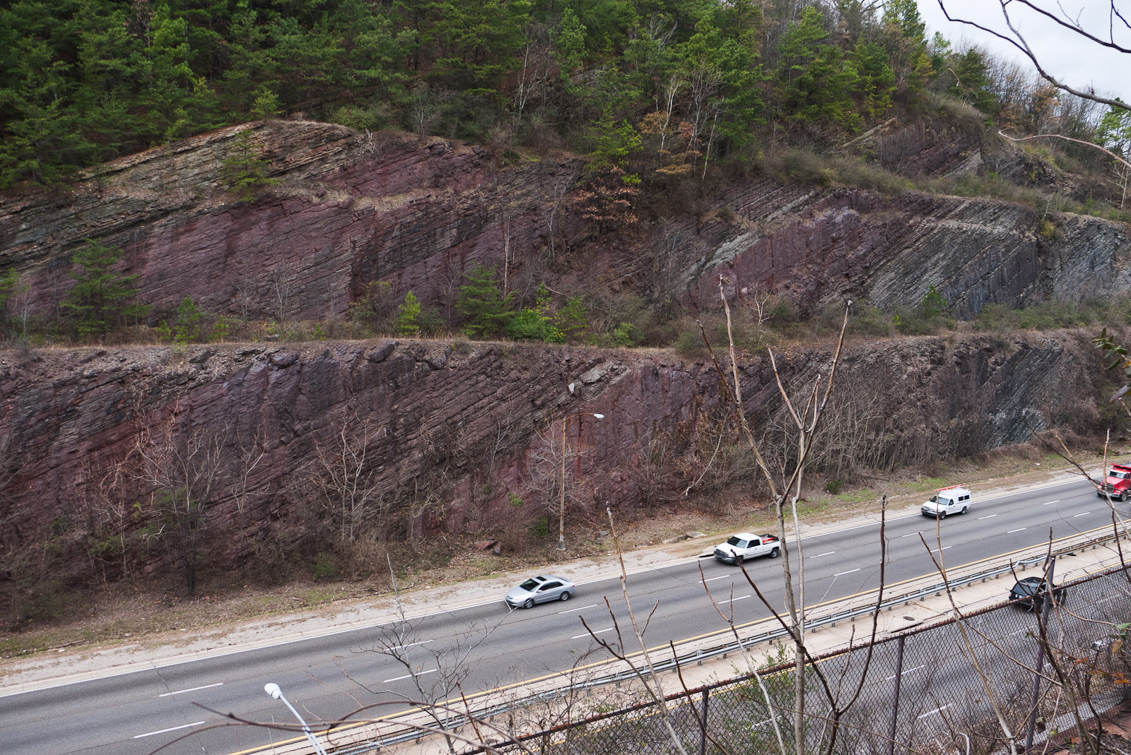
- Red Mountain Park in Birmingham
- A red iron-oxide mineral called hematite is responsible for the red color
- Oak Mountain State Park in Pelham
- Desoto Caverns in Childersburg
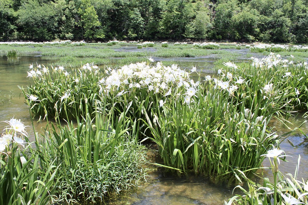
- Cahaba Lily
- White flowers that reach three inches in width
- Only grows in Alabama, Georgia, and South Carolina
- Restricted to habitats with fast flowing water over a rocky surface
- Require abundant sunlight
|
Red Mountain
Wikimedia - Greg Willis
Click on image to enlarge it
Cahaba Lily
flickr - Andy Montgomery
Click on image to enlarge it
|
| |
|
| Piedmont |
| |
|
|
| Description: |
|
|
- Provides a transition between the mountainous reigions to the north and the flat coastal plain to the south
- Mostly rolling plains or hills with steeper ridges and higher elevations in the northern portion of the ecoregion
- Elevation where it meets the flat coastal plain is around 500 feet while upper sections are over 1,000 feet
- Cheaha Mountian, the highest point in the state, is in the upper section and reaches 2,407 feet
|
|
| |
|
|
| Geology: |
|
|
- Contains some of the oldest surface rock in the state
- Outcrops of metamorphic rock (rock that is created from older rocks that have been melted under extreme temperatures and pressures before cooling and hardening into new rock)
- Rock types include granite outcorps, quartz, mica, gneiss, marble, and schist
- Higher ridges are formed from quartzite (such as Mount Cheaha), sandstone, or conglomerate (smaller sized rocks held together by a natural "cement")
- Soils are mostly clay mixed with rocks and are well-drained and fertile
|
|
The word "Piedmont" is derived from the French word meaning "foot of the mountains". The piedmont region is on the edge or "foot" of the Applalchian Mountains, giving the region the characteristics of rolling hills with some ridges and valleys
|
|
| |
|
|
| Habitats: |
|
|
- Ridges are mostly pine forests or mixed forests
- Valleys are mostly hardwood forests
- The piedmont region was once cleared for cotton production but has been converted back to more natural forests
|
Mount Cheaha
Wikimedia - Brian Collins
Click on image to enlarge it
|
| |
|
|
| Notable Landmarks and Species: |
|
|
|
|
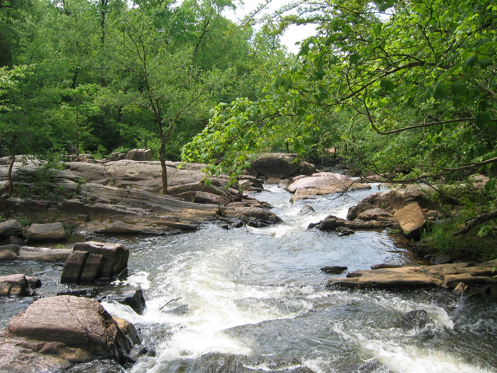
Chewacla State Park
flickr - Outdoor Alabama
Click on image to enlarge it
|
| |
|
|
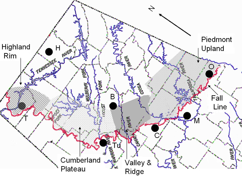
| Fall Line |
- The boundary between the Southeastern Plains and the four ecoregions in the northeast part of the state (Interior Plateau, Southwestern Appalachians, Ridge and Valley, and Piedmont) is called the fall line
- Visible change in landscape and elevation occurs at the fall line
- Northeastern part of the state is characterized by harder rock and higher elevation
- Southeastern and southern part of the state is lower in elevation and composed of softer rock and characterized by sand and gravel
- Rivers and streams that flow over the fall line result in waterfalls, white water rapids, and have a distinct change in elevation
|
Fall Line
Image from the online Encyclopedia of Alabama
(courtesy of Mike Neilson)
Click on image to enlarge it
|
| |
|
|
| Southeastern Plains |
| |
|
|
| Description: |
|
|
- Largest ecoregion in Alabama
- Relatively flat with some rolling hills
- Gradual decline in elevation from the fall line to the coast
- Streams are characterized by having a low gradient (little change in elevation) with sandy bottoms
|
|
| |
|
|
| Geology: |
|
|
- Rock is mostly sedimentary including chalk, sandstone, limestone, and claystone
- Soils are composted of gravel, sand, silt, and red clay
- Blackbelt Region: a strip of land that runs horizontally through the state contains white chalk under the soil which interacts with the soil components to form a rich, black, fertile soil
|
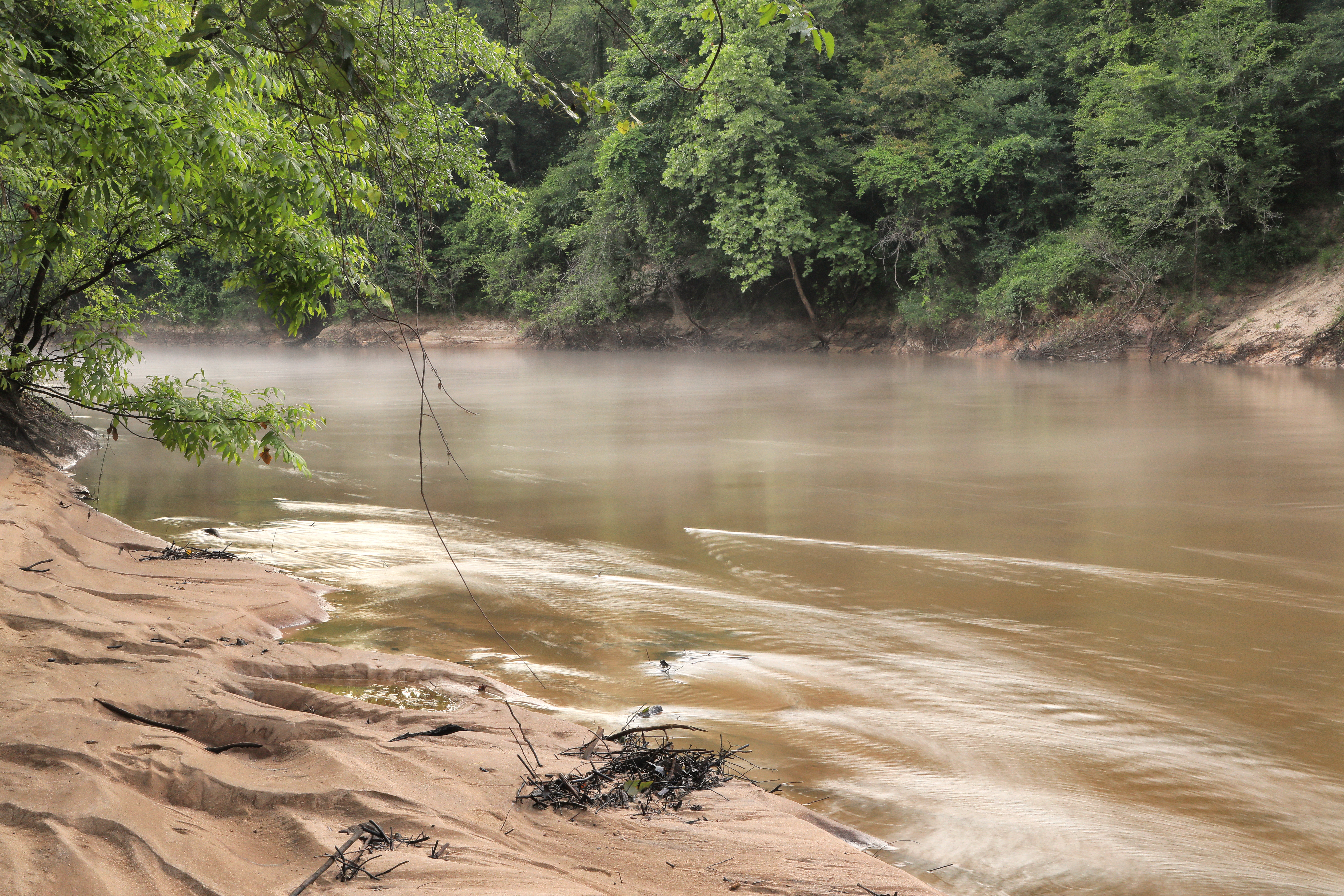
Conecuh River
Photograph by Alan Cressler
Click on image to enlarge it
|
| |
|
|
| Habitats: |
|
|
- Mix of cropland, pasture, wetland, woodlands, and forests
- Forests include oak, hickory, and pine
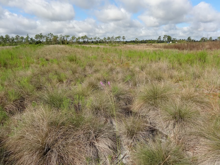
- Wiregrass is the most common herbaceous plant that grows in this region
- Flatlands, swamps, and river bottomlands are abundant in low, flat areas
- Includes floodplains of Alabama River, Tombigbee River, and Black Warrior River
- Cedar trees grow in the fertile soils of the blackbelt
|
Wiregrass
flickr - FWC Fish and Wildlife Research Institute
Click on image to enlarge it
|
| |
|
|
| Notable Landmarks and Species: |
|
|
|
|
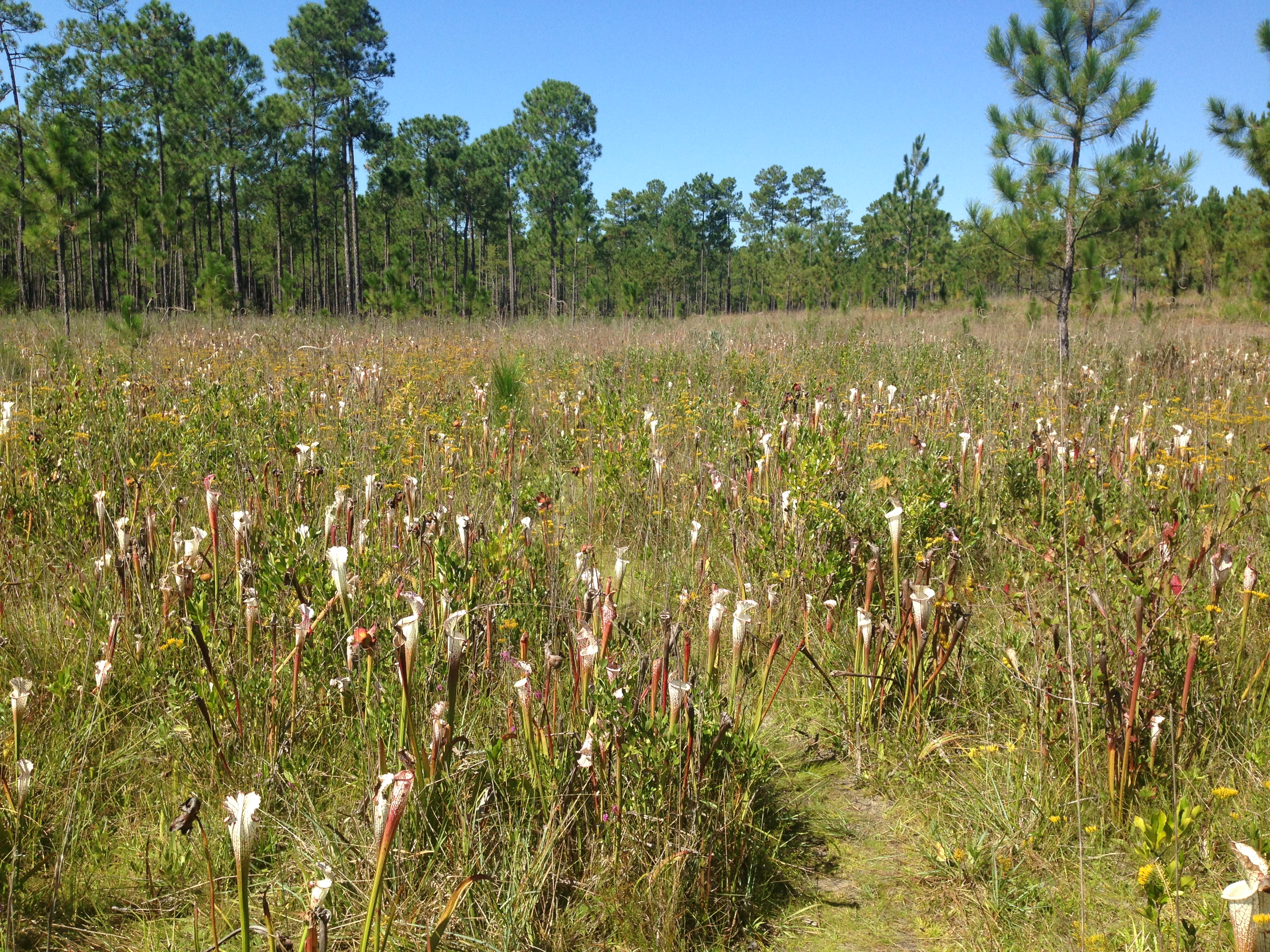
Splinter Hill Bog
photo by Allison Mathis
Click on image to enlarge it
|
|
Splinter Hill Bog
photo by Allison Mathis
Click on image to enlarge it
|
| |
|
|
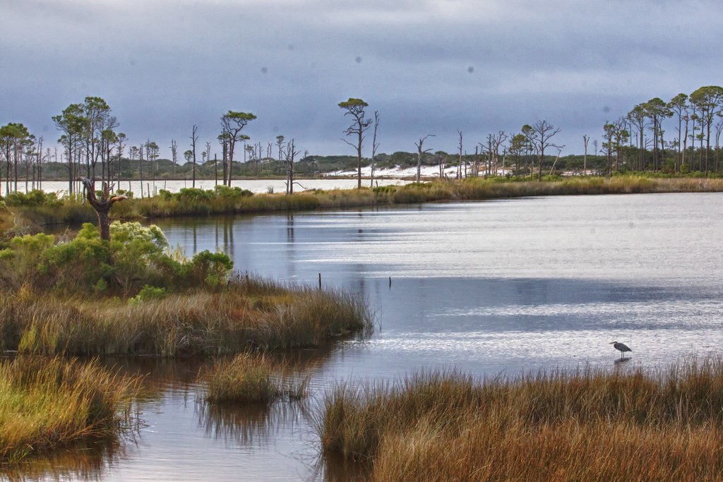
| Southern Coastal Plain |
| |
|
|
| Description: |
|
|
- Smallest ecoregion in Alabama
- Located near the coast
- Mostly flat with swamps, lakes, and marshes
- Warmer weather than other ecoregions
- Receives drainage from various rivers and is constantly taking in new sediment
- Often affected or altered by weather including hurricanes, floods, and erosion
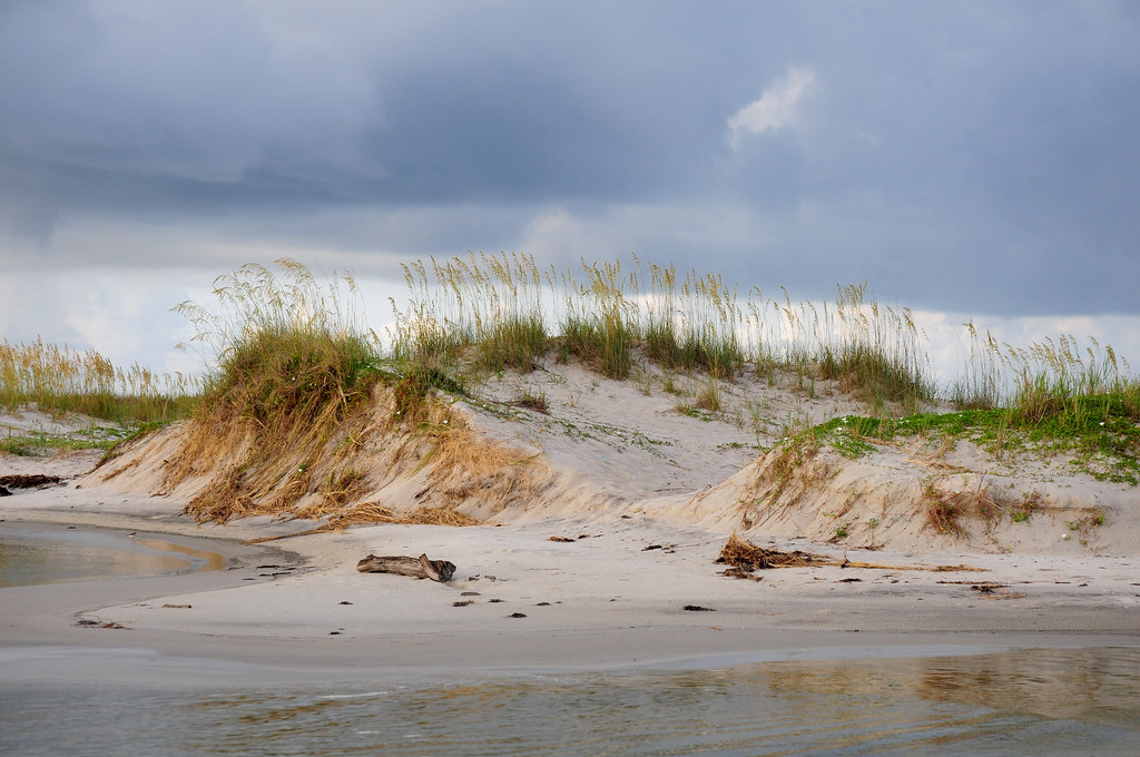
- Includes white sand beaches and swamp lands
|
|
| |
|
|
| Geology: |
|
|
- Soils and sediments are younger/newer than other ecoregions in the state
- Flat, sandy areas
- Soils are made of coarse material
|
|
The beautiful white sand beaches along the gulf coast are made of tiny grains of quartz. These grains were once washed from the Appalachian mountains and moved toward the coast through erosion and the flow of the rivers before being deposited near what is now the shore. |
|
| |
|
|
| Habitats: |
|
|
- Lagoons, bayous, wetlands, and swamps
- Estuaries and salt marshes
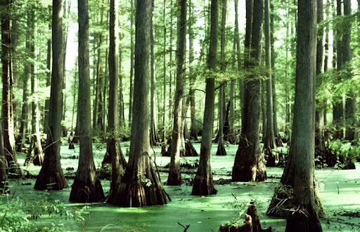
- Oak-gum-cypress forests
- Pine scrub, cordgrass, and saltgrass
- River swamp forests dominated by bald cypress
- Sand dunes
|
|
Bald Cypress Swamp
Image from the online Encyclopedia of Alabama
(Photograph by Manfred Mielke)
Click on image to enlarge it
|
| |
|
|
| Notable Landmarks and Species: |
|
|
- Dauphin Island
- Barrier Island
- Migratory birds can be seen on the island in the spring and fall
- Gulf State Park in Gulf Shores
- Area of undeveloped white sand beaches along with natural freshwater lakes
|
|
Sand Dune at Dauphin Island
flickr - Michael McCarthy
Click on image to enlarge it
|
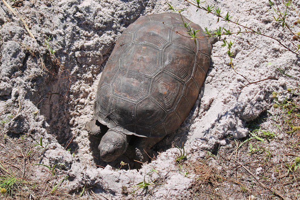
- Bon Secour National Wildlife Refuge in Gulf Shores
- Includes natural beaches, scrub forests, longleaf and slash pine forests
- Provides habitats for the endangered gopher tortoise and nesting sites for the threatened loggerhead sea turtle
- Mobile Tensaw River Delta
- North of Mobile Bay
- 2nd largest delta in the U.S. and largest wetland in Alabama
- One of the most diverse marsh ecosystems
- Provides habitats for black bears and alligators
|
Bon Secour National Wildlife Refuge
flickr - U.S. Fish and Wildlife Service Southeast Region
Click on image to enlarge it
|
| |
|
|
SOURCES USED FOR THIS PAGE:
.
 Wildlife Tag